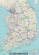
Korea Report - Map of Republic of South Korea (ROK)
An overview Map of South Korea (ROK), depicting all Main Cities, Towns, Highway Connections, Roads Rivers, Sea Bays and Lakes, Airports and Airfields within the Country. Further included are several cities, towns and important locations within North Korea (DPRK), the rough location of the Korean Demilitarized Zone (DMZ) and its maritime counterpart the Northern Limit Line (NLL), the location of various United States and Korean (ROK) Military bases with details of names and stationed units (where available), and a wide variety of small towns and villages in South Korea.
Browse the Map and follow the links to more information on each location, landmarks or monument.
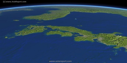
Asia Report - Map Image of Japan, Sea of Japan, Korean Peninsula
This Satellite Image based Map provides a clear overview of most of the Japanese Islands, the Sea of Japan and its Coastline and the Korean Peninsula, including sections of the countries of Japan, South Korea (ROK), North Korea (DPRK), the Peoples Republic of China, and Primorsky Krai Province of the Russian Federation. Marked on the map for orientatation are the names of major National and Provincial Capitals, cities, several towns and villages, oceans, sea's, lakes and rivers, as well as mountains, national borders, and locations of interest.
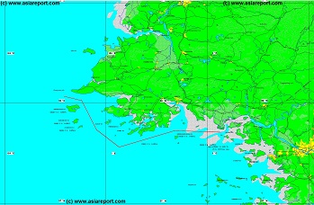
Korea Report - Map of Northern Limitation Line (N.L.L.) - West
A partial overview Map of the maritime border between North Korea (DPRK) and South Korea (ROK), better known as the Northern Limitation Line (N.L.L.). Although accepted by all sides during the Armistice Treaty Negotations, today the N.L.L. remains unrecognized by the Democratic Peoples Republic of Korea, which claims grounds to the south of the Line.
This Map highlights the western half of the maritime border as it is found in the Yellow Sea (West Korea Sea) geographically not too far from both National Capitals of Pyongyang and Seoul.
Marked on the Map are Cities and towns of importance, names of relevant coastal islands, local rivers, etc. Browse the Map and follow the links to more information on each location, landmarks or monument.