This page was last updated on: May 19, 2015
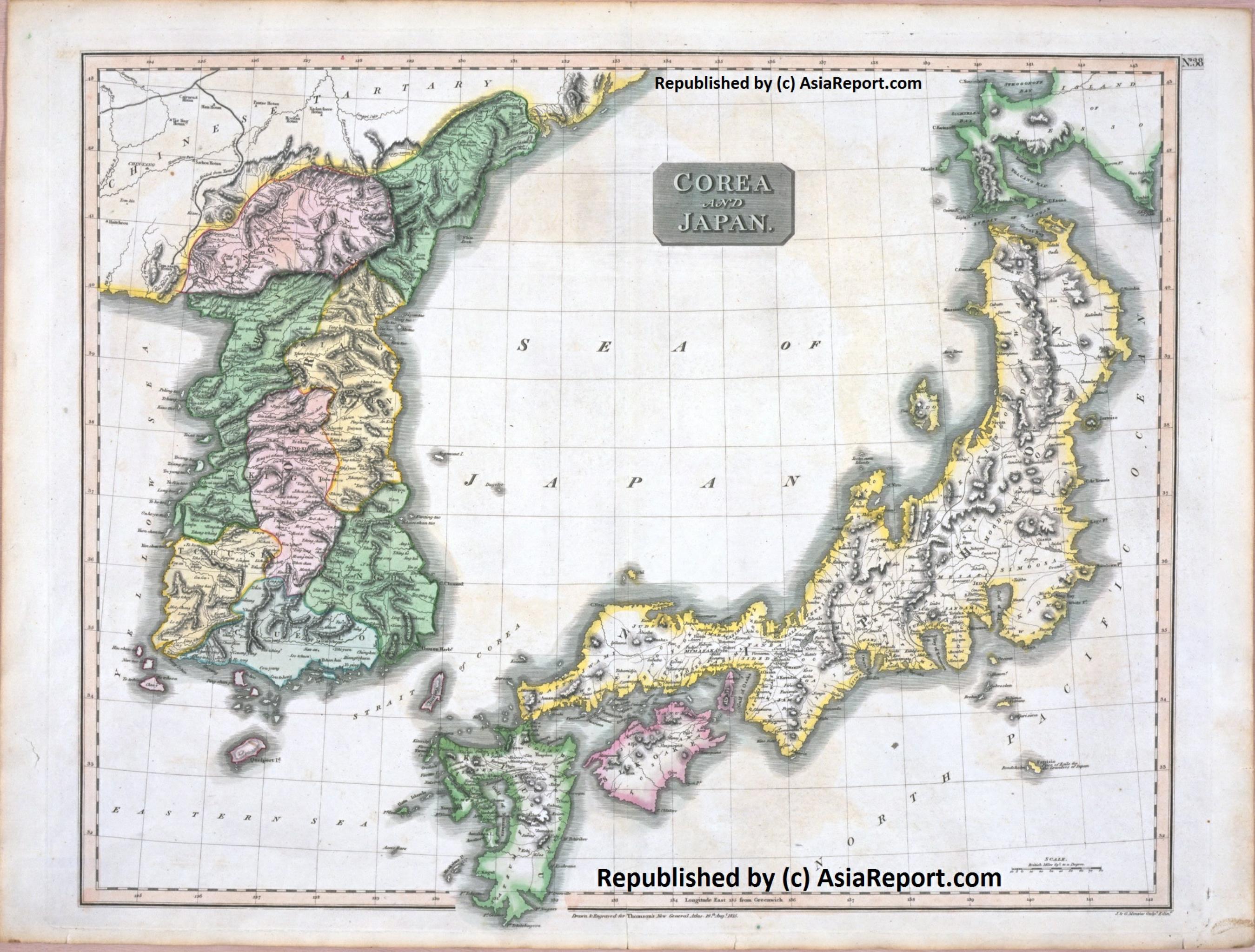
This simplified and dated geographic Map provides a complete overview of Korea in the year 1815. It was taken from an Atlas Published in the year.
The hand-drawn Map provides a rough sense of the relief and terrain in this mountainous country, color coding the various provinces and territories within both nations at the time and roughly delineating their borders. Unfortunately, the quality of the map image in most cases does not allow for the distinction of names of towns and villages even though these are included in the map.
Neighboring nations and regions of Korea are in clockwise direction; Chinese Qing Dynasty held Manchuria along the East and North, a Part of Russian dominated lands in current Primorsky Krai Oblast in the North-East and North, across the Sea of Japan (East Sea) the island nation of Japan in the East and South-East and finally, not depicted on this map across the Yellow Sea, Hebei and Shandong Provinces of China (PRC) in the West and North-West.
Marked on the map for reference are the current day names and locations of Main Cities and Towns, the location of main roads and railways, as well as rivers, lakes and sea's.
Korea Report
Geographic Map Overview of Korea in 1815 AD - 1A
Tieling
Changbai Shan Nature Reserve
- Best viewed in Microsoft Internet Explorer -
A Listing of all available Maps of Korea
AsiaReport.com at
To Main Menu of All Websites at DrBen.Net
Go to www.drben.net webring
Compare Maps - Follow the Links to more information on Locations ! - Click Map Image to go to Full Version ! !
Hunchun, Hunchun County, Yanbian Korean Autonomous Prefecture, Jilin Province, China (PRC)
Tumen
River
Yalu
River
Yalu
River
Ch'UnCh'on, South Korea (ROK)
Changbai Shan (Height: 2194 Meters)
Liaoning
Russia
Selin Shan (Height: 1498 Meters)
Liao
River
Hu Shan - "Tiger Mountain" + Great Wall of China on the Yalu River - East Terminus Outermost Layer in (China i/t) East
a.k.a. East Korea Sea
This page was last updated on: May 19, 2015
My Great Web page
Tieling, Tieling Prefecture, Liaoning Province, China (PRC)
Check out MEGA - 100% Secure file-sharing by Kim.com !!
Yonsa, Yonsa County, North Hamgyong Province, North Korea (D.P.R.K.).
Kilju, Kilju County, North Hamgyong Province, North Korea (D.P.R.K.).
Korea Embassies
Korea Online Sources
AsiaMaps.com - Index
China Provinces /Home
China
AsiaReport.com Home
Asia
Korea Home
Korea
Korea Maps
Koreas Introduction
South Korea
North Korea
Pyongyang (평양시)
Rason
South Pyongan
North Pyongan
Chagang
South Hwanghae
North Hwanghae
Kangwon
South Hamgyong
North Hamgyong
Ryanggang
Seoul (서울시)
Koreas History Timeline
Koreas Store
Historic Maps
Satellite Maps
DPRK Maps
ROK Maps
Koreas Community