Hotels in Ölgii & Sum
Currently there is no information available on the ethnic groups within Ölgii City and District (Sum).
For more information please refer to: Ethnic Minorities of Bayan-Ölgii Aimag (Province).
Ethnic Minorities in Ölgii City & Sum
Learn More about the Ethnic Nationalities in Ölgii
Ölgii Today :
History of Ölgii :
Ölgii Climate & Weather :
Olgii Basic Knowledge :
To The China Report Main Menu
This page was last updated on: May 10, 2017
Ölgii Report
Introduction to Ölgii (Өлгий)
Ölgii Landmarks & Monuments
Ölgii & Area Maps
Location : 20°02′34 North, 110°20′30 East
Elevation : --No information available--
Surface Area:
There is no Basic information available on Ölgii at this Time.
Go to www.drben.net webring
The Mongolia Report
The Ölgii Report is part of the overall website www.AsiaReport.com & www.drben.net
Learn about what is new on this Site from below window.
To Main Menu of All Websites at DrBen.Net
MongoliaReport.com at
Hi! from Doc Ben and Proud Staff
Alphabetically ordered list of Monuments, Landmarks and other sites of interest in and around Olgii
There is no information available on the landmarks and Monuments of Ölgii at this Time.
Public Transport in Ölgii
Main Railroad Station of Dalanzadgad - Photos and Introduction
There is no information available on the Railway Station in Ölgii.
National Airport at Ölgii - More information
Complete Listing of available Hotels in Ölgii, Bayan-Ölgii Aimag, Republic of Mongolia
Ölgii has a Railroad Station as well as a National Airport.
Olgii National Airport is located near Ölgii City.
There is no information available on the history of Ölgii City.

To find out more information on the history of Ölgii City & Ölgii Sum, go to: ′History of  Bayan-Ölgii Aimag (Province)′.
There is no information available on life in current Ölgii in Bayan-Ölgii Aimag.
Find out the Details in the History of Olgii
There is no information available on Hotels in Ölgii City and District at this Time.
There is no information available on the climate and weather in Ölgii City.
For more information refer to: Bayan-Olgii Aimag (Province).
Click Map to go to Full Version !
Be a 7Search.com Advertiser!
Airport : Ölgii National Airport
There are no Maps available on Ölgii City and District at this Time.
Ölgii City & Sum Maps
Click Image to View in Full !
View of the Mosque in Olgii, Bayan-Olgii Aimag, West Mongolia.
Find DrBen and ChinaReport on Facebook with the latest from www.drben.net.
DrBen Nijhoff | Maak je eigen badge
Xinjiang-Uygur Autonomous Region Satellite Map 1A
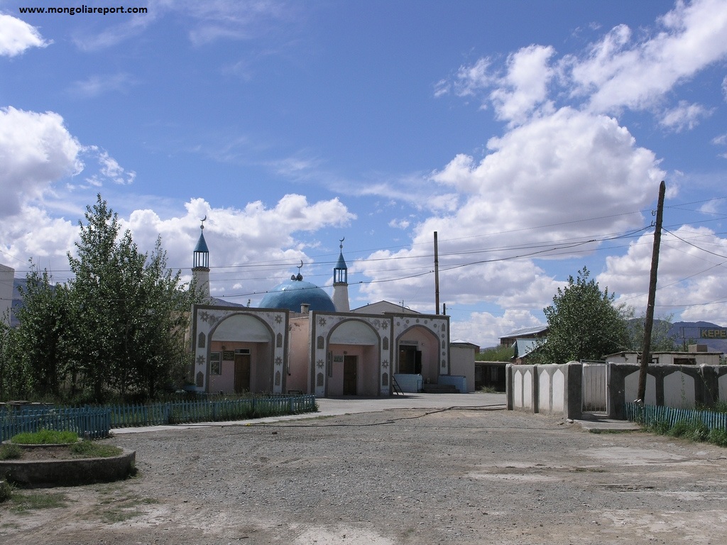
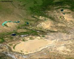
A Satellite Image overview Map of Xinjiang-Uygur Autonomous Region entire and parts of neighboring Nations of India, Pakistan, Afghanistan, Tajikistan, Kyrgyzstan and Kazakhstan, The Tuva, Khakassia and Buryatia Republic of the Russian Federation, The Republic of Mongolia, as well as Chinese Provinces and Territories of Gansu Province, Qinghai Province and Tibet Autonomous Region.
This Map Includes Cities and Towns (shown by size), the Irtush River Valley, the Dzungarian Basin of Xinjiang AR, the Taklamakan Desert in South-Central Xinjiang AR, a variety of border passes in the Karakoram Mountain Range and the Tian Shan Mt. Range, plus main waterways, rivers and lakes of this large region.
Xinjiang AR Satellite Image Overview - 1A
This page was last updated on: May 10, 2017
My Great Web page
#Mongolia Tweets
Bayan-Ölgii Prov.
Ölgii
Ölgii Home
Ölgii Hotels
Bayan-Ölgii Prov. Home
Mongolia Offline Sources
AsiaReport.com Home
Mongolia Report Home
Mongolia Online Sources
Mongolia Maps
Mongolia
Mongolia Online Store
Mongolia Report Club
Bayan-Ölgii Sources
Bayan-Ölgii Economy
Bayan-Ölgii History
Bayan-Ölgii Monuments
Bayan-Ölgii Maps
Bayan-Ölgii Minorities
Bayan-Ölgii Transport
Asia Report Online Store
??
?? Home
?? Hotels
Ulaanbaatar
Ulaanbaatar Home
Ulaanbaatar Hotels
AsiaReport.com
Tweets by @ChinaReportcom1
Follow and Respond to us on Twitter :
Mongolia Travel Community on Facebook