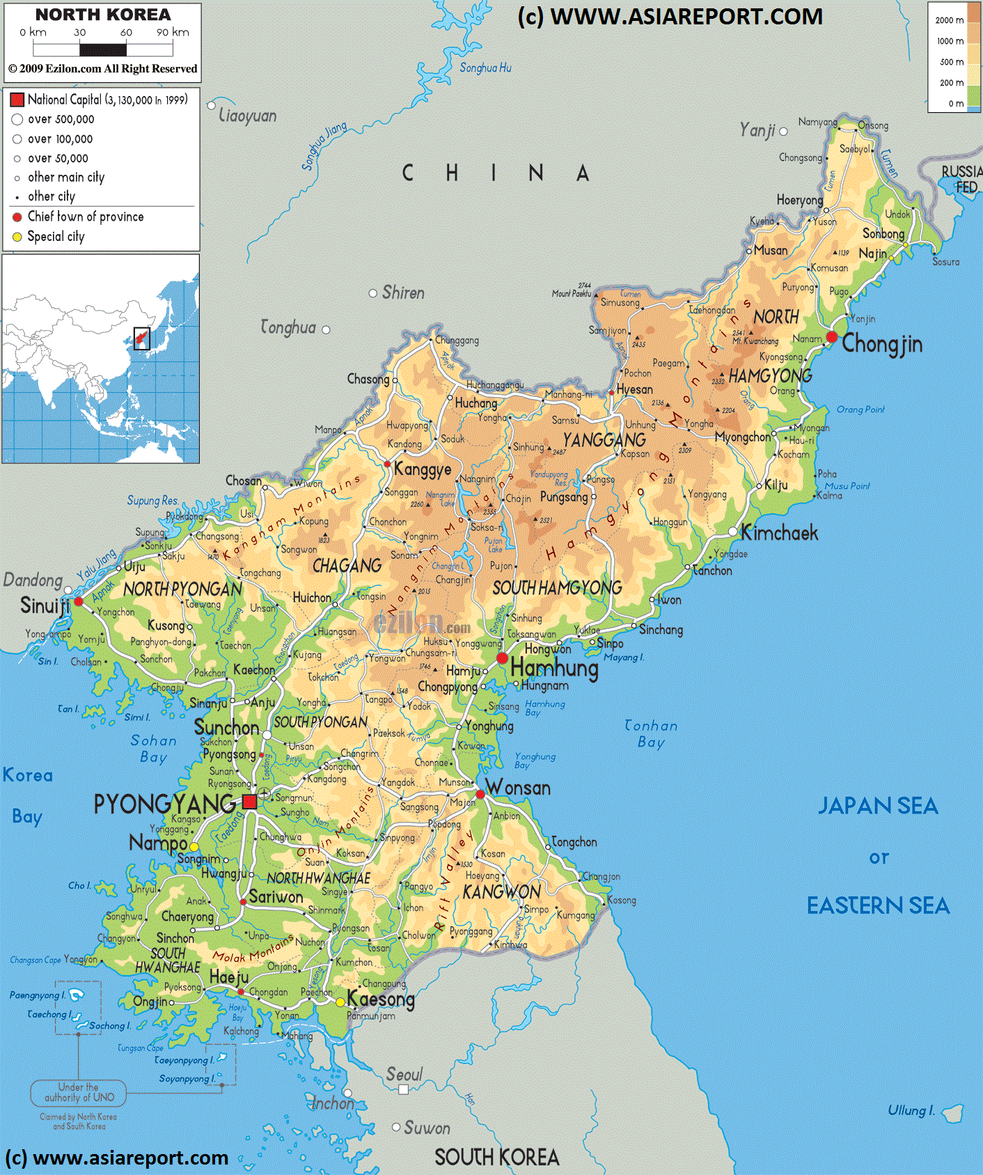
This simplified geographic Map created in 2009 provides a complete overview of the Democratic Peoples Republic of Korea (North Korea), its geographical features, relief, main cities and roads.
Neighboring nations and regions of Korea are in clockwise direction; The Liaoning Province and Jilin Province of the Peoples Republic of China (P.R.C.) along the East and North, a Part of Russian dominated lands in current Primorsky Krai Oblast of the Russian Federation in the North-East and North, across the Sea of Japan (East Sea) the island nation of Japan in the East and South-East and finally, not depicted on this map across the Yellow Sea, Hebei Province and Shandong Province of China (PRC) in the West and North-West.
Marked on the map for reference are the current day names and locations of Main Cities and Towns, the location of main roads and railways, as well as rivers, lakes and sea's.
Korea Report
Geographic Relief Map - Overview of North Korea (D.P.R.K.) 2 A
Changbai Shan Nature Reserve
- Best viewed in Microsoft Internet Explorer -
AsiaReport.comat
Compare Maps - Follow the Links to more information on Locations ! - Click Map Image to go to Full Version ! !
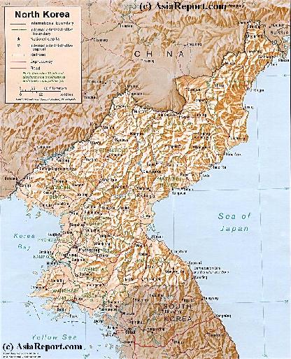
Map of Democratic Republic of North Korea (DPRK) 1A
An overview Map of North Korea (DPRK). This Map inludes Main Cities of North Korea and adjacent regions of South Korea (ROK) and Jilin Province and Liaoning Province of China (PRC).
Further included are Main Roads and Highway Connections, locations of main rivers and mountains, border cities on the Chinese Border and South Korean Border, the 12 main provinces of North Korea, trajectory of Korea's DMZ (De-Milititarized Zone), locations of main historic monuments & tourist sites of the Nation & Region, location of DPRK Main Army and Naval Bases and Yongbion and Yongbion Nuclear facility.
Map under Construction More information to be included soon !!