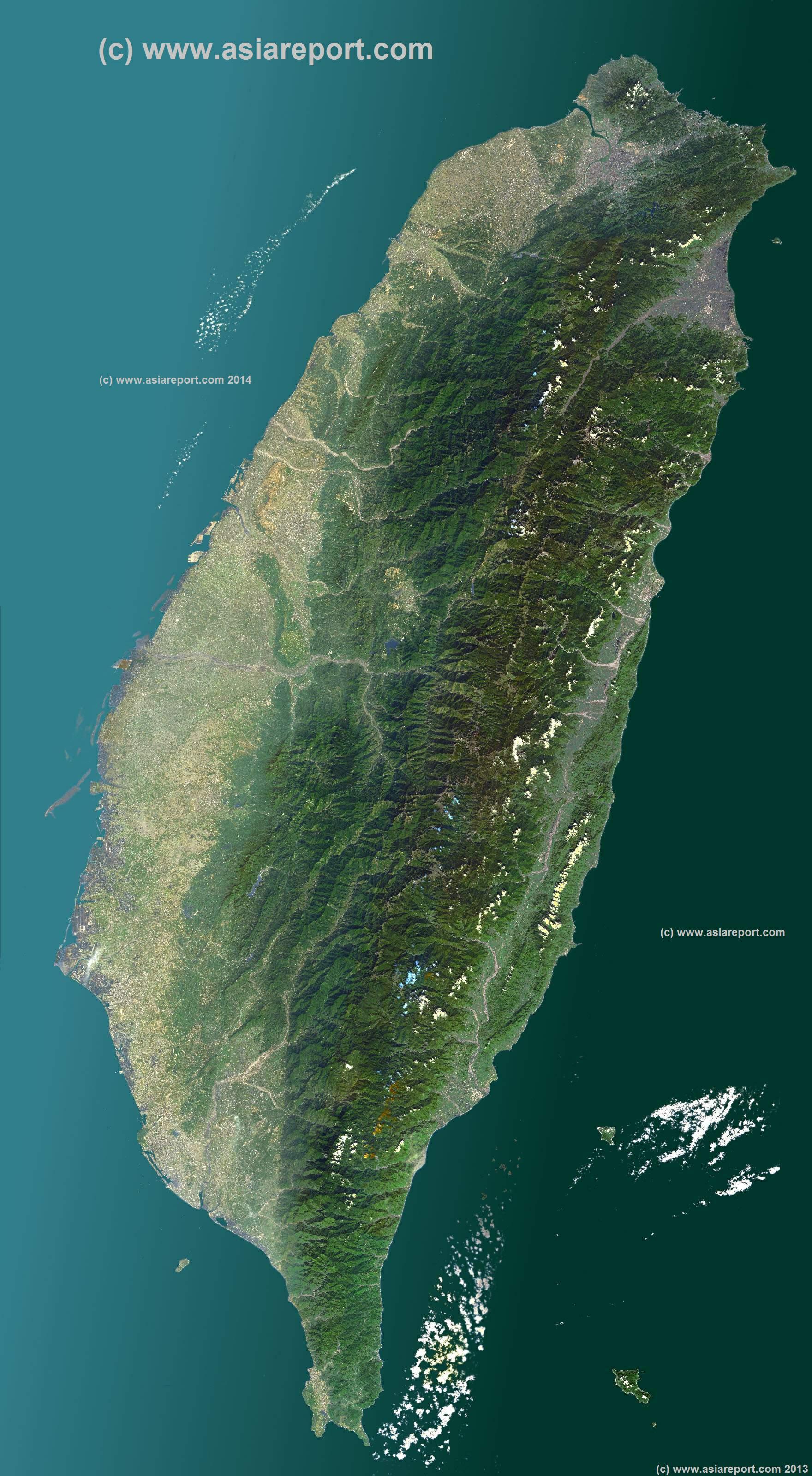
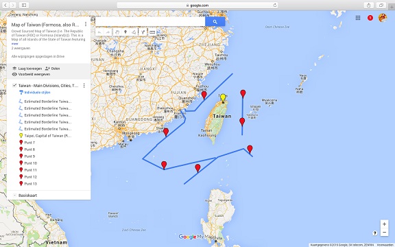
A Satellite Image based overview Map of the Island Nation of Taiwan entire (also identified historically as Formosa, Republic of China or sometimes as Chinese Taipei).
Map includes the entire main Island and several Island groups found nearby however not the Island Group of Penghu, and the Kinmen, Matsu and Wuchiu Island groups which are also claimed by China as part of Fujian Province and also not the Pratas Islands (Atolls)(Chinese: Dongsha Dao) and Taiping Island, a part of the Islands of the South China Sea, in case both claimed by Taiwan ROC and China PRC as parts of their territory and under factual control by Taiwan.
This Map clearly defines Nations, Provinces and Regions, as well as geographical features such as main mountain ranges, famous mountain peaks with heights, main rivers & lakes of the region, basins and plains, plus the locations and names of main cities, towns, monuments and landmarks.
Browse the Map and follow the Links where available to access more maps, information and photos on each location and landmark. Use below satellite image in conjuction with depicted google supported satellite image maps of all Territories controlled by Taiwan, including disputed territories in the South China Sea (Claimed by both China PRC and partially Taiwan ROC, and also other Nations partially).
Asia Report
This page was last updated on: August 26, 2017
Map Asia - Taiwan - Satellite Map Taiwan Version 01
Asia Report - Map of Taiwan; Island of Formosa incl. parts of South China Sea
This Google supported Satellite Map provides a clear overview of the Island Nation of Taiwan, factually independent but also claimed as a Province of the Peoples Republic of China. Map includes National territorial limits,main administrative divisions, main cities, mountains, historic locations, scenic spots and tourism locations. Taiwan territory de facto includes parts of the South China Sea, larger part of which is also claimed by Taiwan as Republic of China (ROC).
Browse the map and follow the links to more information, maps and photos of each location.
Chilung
TAIWAN STRAIT
EAST CHINA SEA
PACIFIC OCEAN
Tao
River
CHUNYANG SHANMO
CHUNYANG SHANMO
Tainan
LUZON STRAIT
Lan Yu
Liuchiu Yu
Kueishan Tao
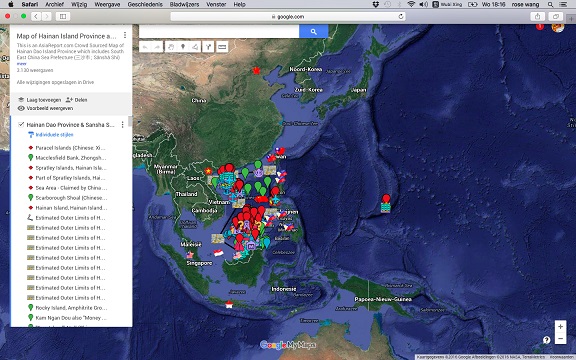
Asia Report - Map of Hainan Island Province China (PRC) including (disputed) South China Sea Prefecture
This Google supported Satellite Map provides a clear overview of Hainan Island Province of the Peoples Republic of China, including its South China Sea Prefecture. Map of the South China Sea further includes parts of Taiwan and coastline, Gulf of Tonkin, coastline of Vietnam, Brunei, Borneo (Malaysia), and western Philippines.
Marked on the map for orientatation are the names of major National Capitals, locally relevant cities, several towns and villages, names of oceans, islands in the South China Sea, as well as locations of interest such as naval bases, artificial island, airfields, tourism locations, etc.
Browse the map and follow the links to more information, maps and photos of each location.