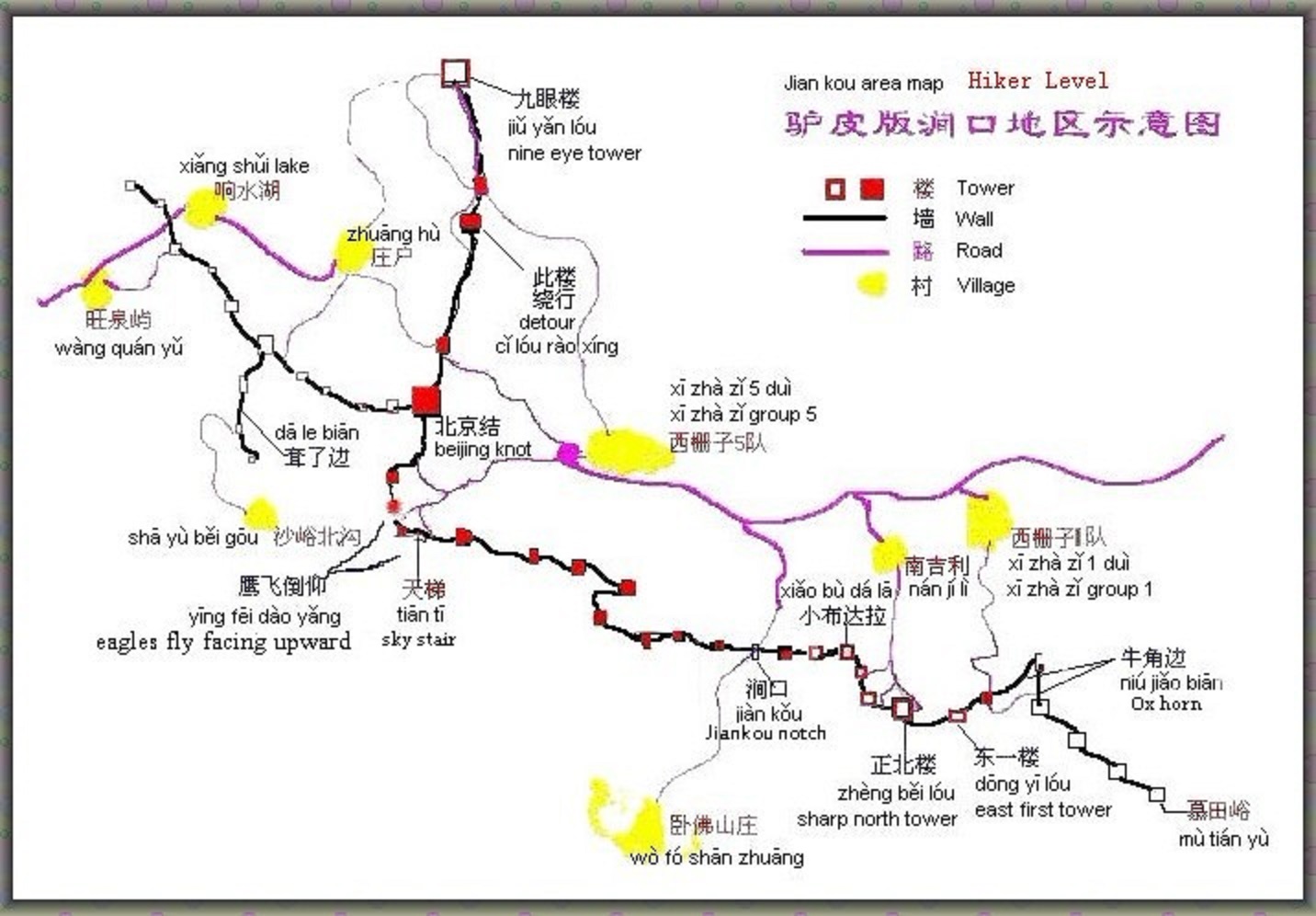
'Jiankou', written in Chinese as 箭口, is translated as 'Arrow Nock' in English, because the shape of the mountain is like an arrow, with the collapsed ridge opening as its arrow nock.
Although at around 8 kilomters (5 miles) of teacherous and tough hiking and climibing fairly short in
Adjacent Map gives direct access to Jiankou Wall Map by Google.
Learn more about the The Great Wall of China, Emperor Qin, his Terrecotta Armies and the horryfying fate of those who opposed him through this fascinating Film-Documentary.
Badaling
Juyong
Guan
Shixia
Guan
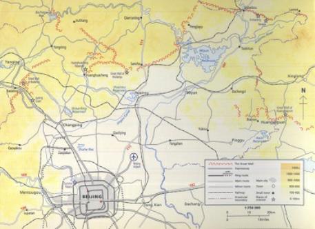
Map - Schematic - Beijing City Province Great Wall Locations
A Schematic Map overview of Great Wall locations and sections in Beijing City Province and Tianjin City Province. This Schematic Map depcits all seperate visitable Great Wall of China locations and sections within the 4 rural districts of Beijing; Pinngu, Miyun, Huairou and Yanqing County. Map further includes as the location of hiking paths, hotels, recreational facilties and historic monuments found in the vicinity of the path of the Great Wall. Find the locations of the Great Wall of China in Yi County in North Tianjin Province from where it continues past its many stations to end in the west at Shixiaguan in Yanqing County. Beyond the Great Wall continues into Zhangjiakou Prefecture of Hebei Province.
length, the Jiankou is regarded as one of the most spectacular and scenic sections of the Great Wall of China in Beijing City Province. Apart from the Zhengbei Tower ( 正北楼) and the Jian Kou itself, Jiankou is most noted for the sensational "Heavenly Ladder (天梯 Tiāntī)", a very narrow steep section of the Wall and a section known as: "Where Even the Eagle Flies Upward (鹰飞倒仰 Yīng fēi dào yǎng). In the latter section of Jiankou the Wallis very steep and leads directly up to every mountain peak creating a jagged ladder sensation when seen from afar.
Beyond Jiankou in the north and west lies a point known as "The Beijing Knot (Běijīng jié北京捷)", which is where two sections of the Great Wall come together. Finally at the north-west end of Jiankou Great Wall proper, it connects to a brief ruined mountain-top stretch known as Jiuyan Lou Great Wall. The Jiuyanlou Great Wall only counts a few broken bases of watchtowers and some sparsely identifyable wall remains, however it is well noted for its eery looking 9 Eye Tower, the Jiuyan Lou. This tower and section are seperatly described on the page: JiuYanlou Great Wall of China.
China Report - Map of the Great Wall during the Ming Dynasty
Satellite image of China and North-East Asia, with a super-imposed schematic Map of the location and Path of the Great Wall as constructed during the Reign of the Ming Dynasty. Included for reference are City names, geographical features of landscape, Names and locations of Passes on the Great Wall of China.