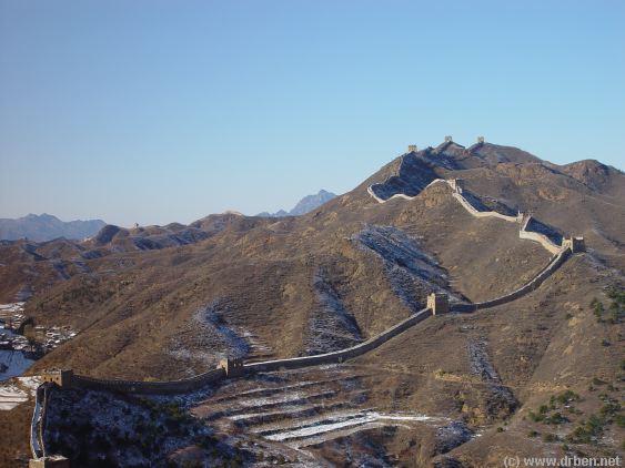
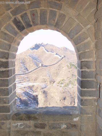
This wintertime Satellite Image gives a clear image overview of the Simatai Great Wall of China
Site due North-East of Beijing. Clearly visible running from the South to the North-West is the Simatai Pass through which runs a River (Icy in winter). The River is dammed where the Great
Wall of China crosses. In the East inside the Great Wall are farmlands of Simatai Village.
The Simatai Park Entrance lies at the south of the Site and is a considerable distance walking from the actual Great Wall entry point, the start of the steep climb uphill on the Great
Wall. From the Parking Space and Park entrance take either a walk (roughly) along
the Eastern River Banks, or, if you would like to conserve your energy for later then
take the open air cable car ride to a point a short but steep walk beneath the Top of
the Simatai Ridge on the Last Simatai Great Wall Tower. The Eastern Wall Section
has been partially closed at its most impressive and dangerous point after a tourist
                                                                               fatally plunged down along the
                                                                               Cliff. The remaining part of the
                                                                               Wall beyond this point is only one
                                                                               brick wide.
                                                                               The Western Section of the
                                                                               Simatai Wall across the River is
                                                                               named JingShanLing and
                                                                               accesible from the West.
Introduction to Simatai Great Wall of China Site Satellite Image
Mouse over Image to Reveal More Details !
Simatai location on the Great Wall of China near Beijing :
Satellite Image of North-Eastern China and Mongolia with the path of Great Wall of China through China. Location and Passes highlighted-  for your reference, by The China Report
Boat-launching pier
Entry Point Simatai Great Wall Section East
Simatai Village
Western Section - Great Wall at Simatai
Arrival and Parking Area
Go to www.drben.net webring
ChinaReport.com at
To Main Menu of All Websites at DrBen.Net
Cable Car Ride - To and From Wall
Click Map to Zoom and View Details
Great Wall of China Map
Path to Great Wall along River
Closed Section (Crumbled Ledge)
Boat-launching pier
Village
Jinshanling
Great Wall
This page was last updated on: June 6, 2017
My Great Web page

View AsiaReport.com - Mastermap of Asia (entire). in a larger map
Beijing Landmarks
Beijing Introduction
Beijing Online Sources
Beijing
Beijing Home
Beijing Hotels
Beijing Maps - Index
Beijing Public Transport
City Province Transport
Beijing by District(s)
Chongwen
ChaoYang
Dongcheng
Fengtai
Haidian
XiCheng
Xuanwu
6 Outer Suburbs
TiananMen Square
Alphabetical Order
By Function(s)
Forbidden City
Hebei Province
Hebei Province Home
China Offline Sources
AsiaReport.com Home
China Report Home
China Online Sources
China Online Store
China Maps
China
China Photo Galleries
China Report Club
4 Rural Districts
Shijingshan
Maps of Chaoyang
Maps of Chongwen
Maps of Dongcheng
Maps of Fengtai
Maps of Xicheng
Maps of Xuanwu
Maps of Haidian
Maps of Shijingshan
Beijing Great Wall Maps
Beijing North China Maps
Historic Maps of Beijing
BJ Public Transport Maps