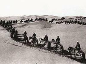
Mongolia, the Wulsins resolved to travel to China as well. From 1921 to 1925, the Wulsin couple, with a grant from the National Geographic Society, mounted expeditions to the far reaches of China, Tibet, and Inner- and Outer Mongolia in order to scientifically study the people, flora, and fauna of the regions. It would take them until the year 1923 to reach Ningxia through which region they passed from North to South, traversing through the gap of the Juicaigou Great Wall of China to Yinchuan, and from this thriving trading city along the west bank of the Yellow River to Zhongwei. The route left Ningxia via Gantang Zhen at the Gansu Provincial border. Famously, the Wulsin "bandwagon" took 28 camels, six horses, four Mongolian camel drivers and 10 Chinese "specimen collectors" to make it through the many difficulties found along the route. After making it into Eastern Tibet and reaching Xining, the Wulsin's made it back to Lanzhou and transferred to a raft for their return journey.
Altogether, the Wulsins collected 1,400 botanical and zoological specimens, and are equally credited to have brought back many 100's of unique photographs and documented Buddhist rituals. They also took hundreds of photographs of now destroyed Tibetan Temples, documented tribespeople and desert landscapes.
In 1926, National Geographic published one account of their expeditions, but Janet's considerable and scientically and historically worthy contributions went uncredited. Stray newspaper articles in the United States were often misleading or inaccurate about her significant role. The Wulsins returned to the United States in 1925, and later divorced. Elliott remarried Richard Hobart, a banker and collector of Chinese art.
Janet's role in her first husband's expeditions went largely uncredited until after her death in 1963, when her daughter, Mabel Cabot, found her mother's private letters and diaries and published Vanished Kingdoms (ISBN 0-641-68638-2), a biographical account of Janet's explorations featuring many of the magnificent black & white images taken during the long years of the mission. These photos remain among the very few recorded in these regions at the time.
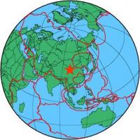
During the Sino-Japanese War (1937–45) parts of Ningxia were incorporated into the Shaan-Gan-Ning border region (better known as the Ningxia-Hopei-Chahar Region).
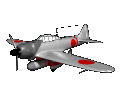
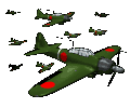
Lying protected by many natural bariers and the lack of proper roads, Ningxia was for the time being protected from a full scale Japanese Military assault. While large scale Wars were still raging across the regions to the North and to the East, the main military threat in the Ningxia Region came from Japanese Aircraft not their mechanized armies. They could not penetrate there, or, of they did they could not hold on to the land. For this reason, it was in Shaanxi that a last Communist Soviet was in function, and this then was the Ningxia-Hopei-Chahar border region where -after their arrival from the Long March in 1936 AD- the Chinese Communist Party founded their new (and only) Communist Base Area.
Although support from the local peasantry was traditionally strong in other rural area's throughout China, in Ningxia -among the Muslims- enthusiasm for the Chinese Communist Party was far less high. The Communists usually appealed to local ethnic groups for support by proclaiming respect for their cultural and religious habits and promises of equality and far reaching political rights. However, although some Hui leaders joined the communists and rose to positions of influence in the Red Army and Party, most members of the then dominant Hui Ethnic Group distrusted these promises and were far more interested in their own independence through the ruling of their Leading Ma Clan (Ma=Horse, is a common name among the Hui) of Warlords, known in China as the Xibei San Ma brothers (literally "three Ma's of the northwest").