Transportation from Yulin Yuyang Airport to the city follows the usual pattern. That, is for arriving and exiting travelers there are shuttle buses available which travel the short distance between the airport and the main bus station of city, as well as limited other locations.
Travel by bus is the cheapest option.
As a secondary option there are always the local Taxis, which, one may rest assured, are available at just about any Chinese Airport virtually around the clock. Mind you, the worse the hour, the higher the demanded fares. However, keep to the usual instructions for taking cab rides from Airports in China. Avoid pushy drivers and hustlers. Find your own cab, not the other way around. Negotiate a fair price and make sure the meter is switched on. Distance between airport and absolute city central is 15.5 kilometers.
As for public transport in Yulin City in general. Please note that Yulin has a Main Railroad Station, which allows for local connections to among things Yanan City to the South and the county town of Shenmu in the north. Travel by train to get around to some of the scenic sights in north Shaanxi Province. For exploring around Yulin City private transport or a hired taxi are an obligatory need.
For additional information on public transport in Yulin and City Prefecture, please link through using below button:
Yulin Yuyang Airport started construction in the year 2005 and was opened in the year 2008. The previous airfield in Yulin City Prefecture was known as Yulin Xisha Airport and the nearest airfield was historically the one situated at Yanan, the city which became famous in the 2nd half of the 1930s during the heydays of the Shaanxi Communist Party Base. Yulin Xisha Airport was closed after the opening of Yulin Yuyang Airport with its designations and airport codes being transferred to the new Yuyang Airport which today still operates under these.
Currently, there is no information available on any of the facilities at the airport.
A growing list of airlines operates flights to and from Yulin Yuyang Airport. Currently, the operators active at the field are; Air China,
China Eastern Airlines, China Express Airlines, China Southern Airlines, China United Airlines, GX Airlines, Hainan Airlines, Joy Air, Okay Airways, Sichuan Airlines and
The Yulin Report is part of the overall website www.ChinaReport.com & www.drben.net
Learn about what is new on this Site from below window.
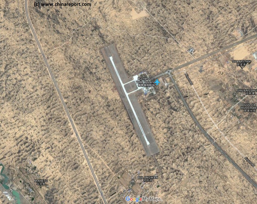
Yulin Yuyang Airport is the first and modern day airport to serve the city of Yulin and the wider City Prefecture of Yulin. With Yulin situated in the north of Shaanxi Province upon the hilly and craggy loess plateaux, the Yulin Airport is situated in a previously hilly but now flattened area very near the city of Yulin at a distance of only some 15.5 kilometers due north-west of City Center.
Yulin Yuyang Aiport is conveniently located in the Yuyang District which is the central district of the Prefecture which forms Yulin City proper. Constructed only as late as the year 2005, the airport brings unprecedented connections to a city which was previously counted as a remote out-corner of the Province. Notably, the alternative option for travel far beyond Yulin is the Yulin Main Train Station. The airport mainly serves the local oil and mining industry, as well as the tourism industry targeting Yulin as an important historical location along the Great Wall of China throughout the various Dynastic periods. TIn fact, the airport is situated but kilometers from the main tourist highlights of the city, among them most notably the "Pacifying the North Tower" of the Ming Dynasty Era Great Wall. The noteable landmark not only represent the largest and biggest "watch tower" to be found along the length of this Great Wall, it is also has an interesting history of relations with the neighboring Mongolian Peoples who lived just across the wall in the (originally) grasslands beyond. Depending on route and direction, travelers to Yulin may be able to discern the tower from up in the air during take off or landing procedures adding quite some thrill to the ride.
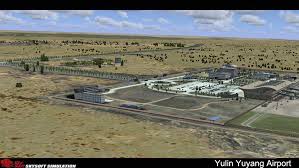
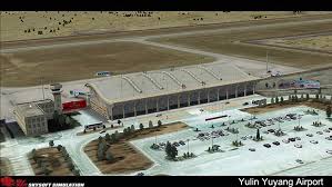
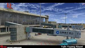
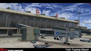
Interestingly, the Yulin Yuyang Airport is included in the epic flight simulator software series FSX by Skysoft simulations. Fans of flight simulators with enough computing power under their hand can visit the airport, review its main features in 3D and of course, have a go at landing and take off from the airfield. Unfortunately, this is so far also one of the few ways one may find or get a good impression of this airport. Airport review videos are non-existent across China (possibly due to security concerns and police discouragement) and does not exist for Yulin Yuyang Airport. In addition, photos are also rare, or at least they are on the Non-Chinese internet so far.
Yulin Yuyang Airport is classed as a Civilian Type 4C Airport allowing for the landing of Boeing 737, Airbus and other C-Clas aircraft and has but single runway. This runway with so far unidentified designation (possibly (15/33) has a length of 2800 meters (9186 ft). So far, there is a modest passenger terminal with 3 sleuce gates for receiving passenger planes. Parking space for additional aircraft appears limited.
Passengers traveling through Yulin Yuyang Airport may be relieved to know that this airport sees very few
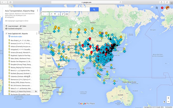
Asia China Mongolia Transportation - Airports & Railroads Satellite Map
This Satellite Image provides an overview of all International Airports in Asia, all Airports in China (PRC) and Mongolia. In addition all military airbases in China (PRC) listed.
Navigate map and click pins for additional information and video where available. Link through from any pin to location information and backgrounds.
Overview all transportation in the Peoples Republic of China and additional Asian Nations in one glance.
Direct Hotel & Resort booking + additional packages linked by location across China, Mongolia and neighboring Asian Nations.
Overview of Yulin Yuyang Airport on (Google supported) Satellite Image Map in March of 2017.
Images of Yuyang Airport in FSX Flight Simulator by FsDeveloper.com
The first airfield in Yulin City was a military airfield opened in 1958. Successively there were Yulin Nanjiao Airport, Yulin Xisha Airport and now Yulin Yuyang Airport.
The previous Yulin Xisha Airport had opened in the year 1988, however while operational the airfield remained unsatisfactory for a number of reasons among them the low altitude position of the field. At a later date, with a rapidly developing airline industry and national travel market, it was decided that Xisha Airport ultimately failed to meet the requirements for the future, a planned runway extension was cancelled and the decision was made to construct an entirely new airfield in zone to be flattened for this purpose due north west of town.
The original runway at Xisha Airport was designated (15/33) and was some 1500 meters in length. This runway was however closed in March of 2008, subsequently demolished and no longer exists.
There are no reports of incidents or accidents occurring at Yulin Yuyang Airport.
If you have any information, photography or video to share on Yulin Yuyang Airport, please share with us in the China Travel Community on Facebook, see below window.
flight delays and is indexed as very low on any nuisance levels.
There are no signs of military activities at the field, of preparations for installing military equipments such as pads for placing surface-to-air missile defense.
Nearest Airports to Yulin Yuyuang Airport are:
Dongsheng Ordos City Airport at 128 kilometer (68 (Air) Nautical Miles)
Luliang City Aiport in Shanxi Province at 152 Kilometers
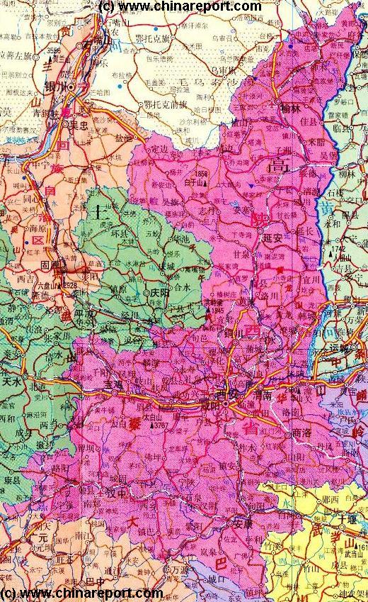
China Report - Map of the Great Wall during the Ming Dynasty
Satellite image of China and North-East Asia, with a super-imposed schematic Map of the location and Path of the Great Wall as constructed during the Reign of the Ming Dynasty. Included for reference are City names, geographical features of landscape, Names and locations of Passes on the Great Wall of China.