This page was last updated on: February 9, 2011
China Report at
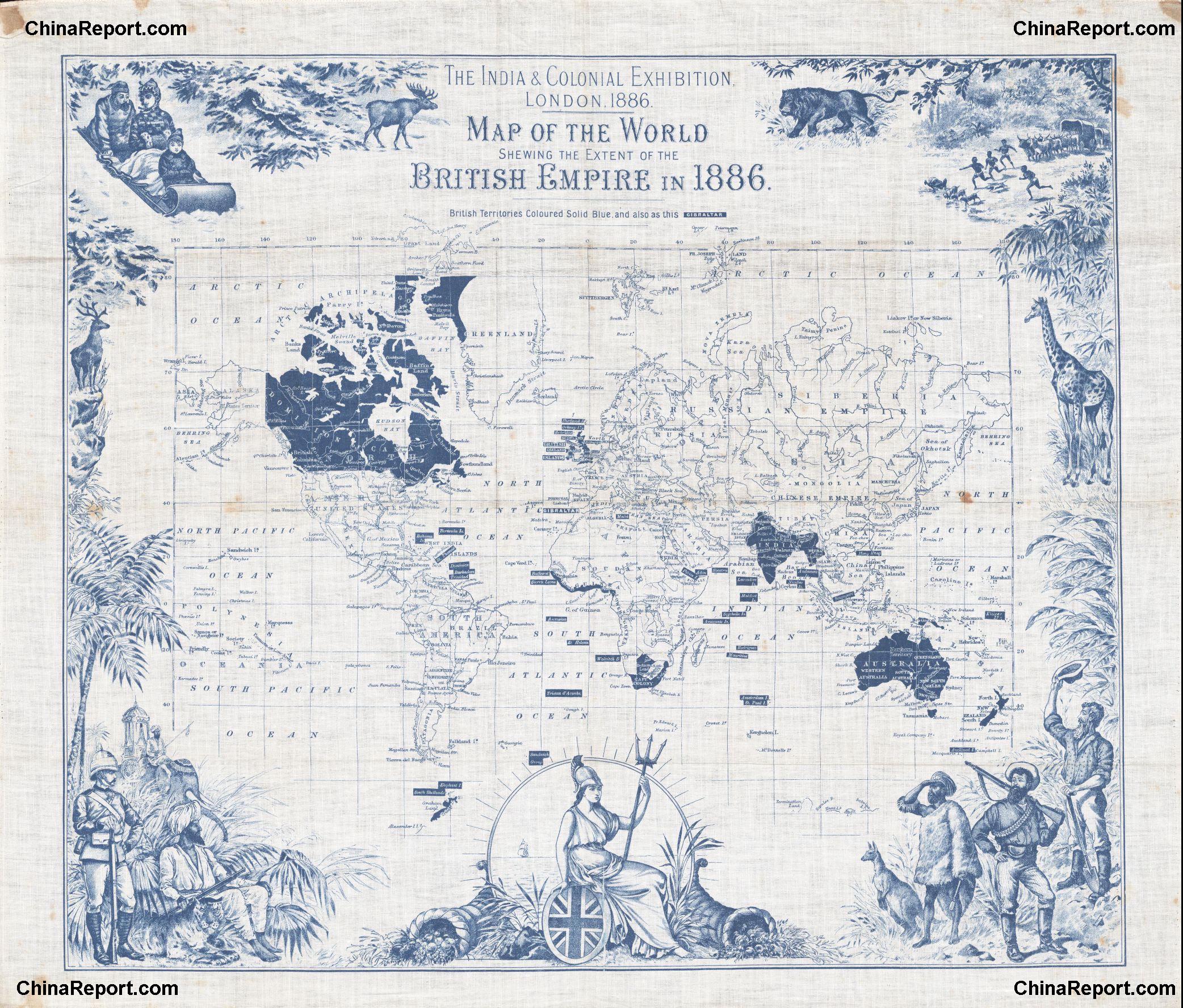
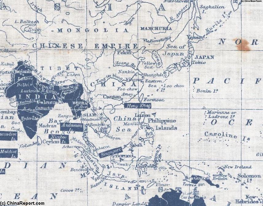
This Map of 1860 AD depicts the British Colonial Empire in the year 1860 AD. The American Colonies have declared themselves independent from the British Empire after a War. The overseas Empire is expanding rapidly into Africa, the middle-East, South-East and now East-Asia and China. Especially marked (        in green) the Area of East-Asia relevant to this Website.
The China Report
Map of Far East : China and British Empire in 1860 AD.
Click to Zoom on Area !!
Macau (Island)
Guangzhou (Canton)
All China Maps used in The China Reporter Website
All China Maps used in this Website
Designates British Imperial Territory (1860 AD)
Shanghai
Hong Kong (Island)
Beijing
Lhasa
Xi'An
Kabul
Rangun
Kuala Lumpur
Kathmandu
A Map showing the Same Area during 17Th Century
Singapore
Nagasaki - Deshima Island (Dutch Trading Post)
Batavia (Dutch Asian Capital)
The China Report Main Menu
All China Report Maps
A Map showing the Same Area during 17Th Century
Highlighted Area - Click for Map
Go to www.drben.net webring
To Doc Ben's Webring
Lanzhou
Kashgar, Chinese Turkestan
Yinchuan
Fuzhou
China Maps
China Online Sources
China Offline Sources
China Online Store
China Photo Galleries
Satellite Maps
Art & Culture
History
DrBen.Net Home
China Provinces /Home
DrBen.Net Partners
China
Asia Countries /Home
Asia
China Report Club
Blog
Chat
Forum
Provinces Maps
China Politics
China News
City + Site Maps
Historic Maps
Be a 7Search.com Advertiser!