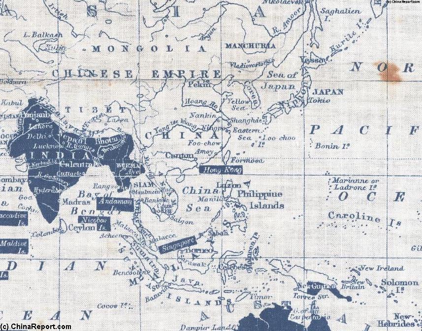
This Map depicts the British Colonial Empire in Asia in the year 1860 AD. Clearly marked are some of the Important cities in the Region. After establishing a strong military and economic base in India during the 16Th Century the British overseas Empire is now encroaching upon Eastern Asia and China in particular. After years of British attempts to establish ("free") trade with China, the first Opium War of 1840-1842 AD and Chinese defeat, bring 5 treaty ports ( Canton, the island of Amoy, Foochow, Ningpo and Shanghai) and the Colony of Hong Kong into the Empire. A second Opium War of 1860-1862 brings further Treaty Ports and Chinese concessions, opening the Grand Imperial Game for China. India, then still united and large, and Nepal are British. Indo-China, now still Annam a Chinese Tributary State will soon fall to the encroaching 3rd French Empire. The Phillipines are an American Colony and the Dutch have large colonial territories in the Indonesian Archipelago (Java, Sumatra, Borneo), New Guinea and the Moluccas ( Dutch East-Indies).
The China Report
Map of Far East : China and British Empire in 1860 AD.
Designates British Imperial Territory in Asia (1860 AD)
Designates British Imperial Territory in Asia (1860 AD)