Dunhuang City County of Jiuquan Prefecture Today :
History of Dunhuang :
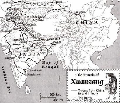
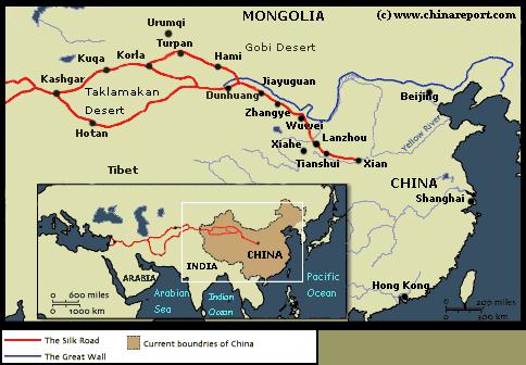
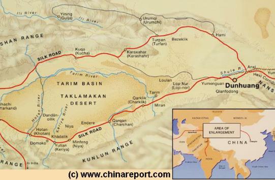
Geographic & Historic Maps on Datong City, Great Wall of China, nearby Gobi Desert Satellite Image including the position of Dunhuang and Buddhist Holy Mountain Area of Sanwei Shan, West Gansu Province.
This page was last updated on: July 27, 2017
The Dunhuang Report
Introduction to Dunhuang
Dunhuang Landmarks & Monuments
Dunhuang City& Area Maps
Dunhuang is a small provincial city in the Far West of West-China's Gansu Province with a Long History. Founded no less than 2000+ years Ago during the Han Dynasty and not very long after the founding of China as a unified State, the city first originated as Shazhou, a stronghold and garrison City, located on China's Western Frontier nearby a pass on the Great Wall of China, the First Pass under Heaven giving access to Barbarian Lands of Central Asia. Buried in the safety of the rough surrounding mountains and deserts ...
The China Report
The Dunhuang Report is part of the overall website www.ChinaReport.com & www.drben.net
The First Pass under Heaven in the West, the famous Yu Men, Jade Gate dating to the Han Dynasty Era.
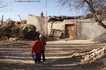
Scene from a Farm Road near White Horse Dagoba in Dunhuang.
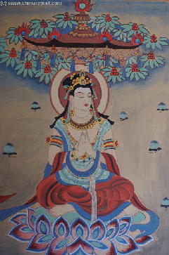
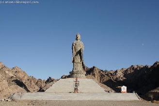
The Gargantuan GuanYin Statue of the Sanwei Mountain Temple Complex, just 18 Kilometers South-East out of Dunhuang.
ChinaReport.comat
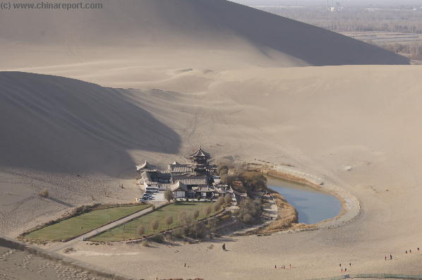
The Silk Road Dunhuang Hotel - Great 4 star-service on stonesthrow from Sand Dunes and Crescent Moon Pool !
Famed Murals of Mogao and other Buddhist Holy Caves near Dunhuang.
A Satellite image of China and East-Asia, with a super-imposed schematic Map of the location and Path of the Great Wall as constructed during the Reign ofthe Ming Dynasty. Included for reference are City names, geographical features
of landscape, Names and locations of Passes on the Great Wall on the Great Wall of China.
Please browse around the City of Dunhuang and wider Area using our Geographic & Historic Maps. Find out more about the City and Area through our many Photographic Reports on the main historic landmarks and Monuments and their rich history.
Not included (yet!) are the Cang River City Ruins, the Yadan Landforms, The Great Wall of China at YangGuan Pass and other Monuments in the wider area of Western Gansu Province.
A Full listing of Dunhuang City Landmarks, Monuments, Hotspots and other sites of importance in alphabetical order. Search through the list to find your Full Report and Photo-Virtual Tour of each monument or landmark within the City, or find Mogao 1000 buddha Caves, Western 10 Thousand Buddha Caves or other Monuments of the Area surrounding Dunhuang.
Dunhuang Public Transport
The Main and only Railway Station of Dunhuang City, located due East of the City Center of Dunhuang and some distance away along the highway to the East. As the arrival point for many, the Main Station is home to a number of essential Services. as is the Dunhuang Airport.
More information Coming Soon !!
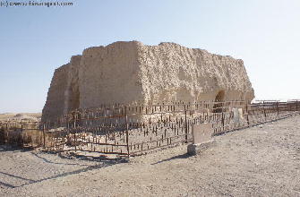
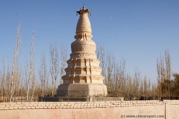
The simple but magnificent Dagoba or Stupa of the White Horse, a Silk Road Monument dating to the year 384 AD.
Music Bonus - "Tunhuang"- Kitaro.
the Chinese
nuclear-weapons test site at Lop Nor..
Dunhuang City is a part of the larger JiuQian City Prefecture, which stretches some 500 kilometers from east to west along the ancient Silk Road, now the Lanzhou-Urumqi Highway. Together with Yumen (80 000) and Dunhuang (30 000) are county seats in the region
Fa Hsien: Le Hao, the prefect of T'un-hwang, had supplied them with the means of crossing the desert (before them), in which there are many evil demons and hot winds. (Travellers) who encounter them perish all to a man. There is not a bird to be seen in the air above, nor an animal on the ground below. Though you look all round most earnestly to find where you can cross, you know not where to make your choice, the only mark and indication being the dry bones of the dead (left upon the sand).
After travelling for seventeen days, a distance we may calculate of about 1500 li, (the pilgrims) reached the kingdom of Shen-shen [=?Lou-lan, near Lop Nor], a country rugged and hilly, with a thin and barren soil. The clothes of the common people are coarse, and like those worn in our land of Han,
- no information available.
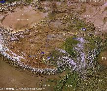
Map-TibetanPlateaux-SatelliteImageOverview 1A
A SatelliteImage overview Map of the entireTibetanPlateauxincluding parts of bordering regions of Xinjiang-UyghurAR, Gansu Province, NingxiaHuiAR, Inner-MongoliaAR,Sichuan Province,andYunnan Province. Surrounding nations and Territories are: Myanmar (Burma), Bhutan, Sikkim, Nepal, Bangladesh, India, Kashmir and Pakistan.
This Map clearly defines Provinces and Regions, main mountain ranges, main rivers & lakes of the region, locations of main cities and landmarks.
Find DrBen and ChinaReport on Facebook with the latest from www.drben.net.
Elevation : Baiyin City: 1,698 meters (5,571 ft) ; Prefecture: The terrain is higher in the north and south parts having a elevation of 1275 meters to 3321 meters.
Surface Area of Prefecture: 21,209 km2 (8,200 sq miles). Urban: 3,478 km2 (1,343 sq miles).
Population: The Total Population of Baiyin City and its Prefecture was counted at around 1.8 million in the year 2010 census, up from 1,670,000 (urban 270,000) in 1996.