Introduction to Chifeng Prefecture of Inner Mongolia Autonomous Region
Shenyang
Tianjin
Taiyuan
Beijing
Ulanbataar
Banaan Tari Nor
Gashuun Nor
Dalay
Lake
ChinaReport.comat
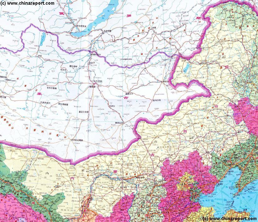
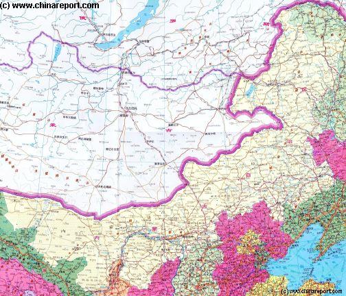
Inner Mongolia AR of China
- Click Map to Enlarge to Full Detail -
Inner Mongolia AR includes ...
The Topography of Inner Mongolia Autonomous Region can general be seen as follows - In the North and North-West ...
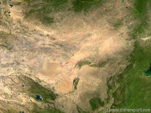
Map of the Gobi Desert & Yellow River Flow
Satellite Image Map of the Gobi Desert Region. Map overviews North-West Xinjiang Autonomous Region, Mongolia, Inner Mongolia and North and North-Eastern China giving a Full Overview of the Gobi Deserts and Yellow River Basin. Map includes country borders, name + location of Cities and Villages (clearly visible).
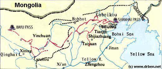
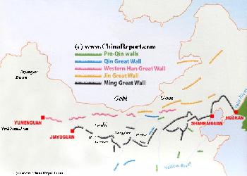
China Report - Map of the Great Wall during the Ming Dynasty
Satellite image of China and North-East Asia, with a super-imposed schematic Map of the location and Path of the Great Wall as constructed during the Reign of the Ming Dynasty. Included for reference are City names, geographical features of landscape, Names and locations of Passes on the Great Wall of China.
Map Great Wall China - Layers of Dynasties and Era's
A Schematic Map of China and East-Asia, with a super-imposed schematic of the various layers of the Great Wall of China.
Features Pre-Qin Dynasty Wall, Qin Dynasty Wall, Western Han Great Wall of China, the (Northern) Jin Dynasty Great Wall and finally the Ming Dynasty Great Wall as mainly remains today.
Main Features are Names and locations location of Passes on the Great Wall of China, outer layer and inner layer. Includes Shanhai Pass, Huangya Guan (Yellow Cliff) Pass, JiYunGuan Pass, Ningwu Guan Pass, Pingxin Guan, YaMen Guan Pass, Pian Guan Pass, JiaYuGuan pass, YuMen Guan Pass (Jade Gate) and Yang Guan Pass.
Further included for reference are City names, geographical features of landscape and main mountain ranges. Updates occur several times a year adding new pass locations and photo-virtual tours of Passes throughout China.
A Full and complete Map of China (PRC) identifying all Language Areas big and small in all Provinces and Autonomous Regions of China.
Map includes Turkic Languages (Uygur, Kazakh, Kirghiz, Salar & Uzbek), Mongolian Language and Sub-Divisions (Mongol, Tu, Daur and Dongxian), Tungusic Peoples (Oroqen, Evenki and Xibe) and Languages, Korean, Tajik (Tadzhik), Mon-Khmer (Kawa + Puman (or Pulang)), Hui, Uygur (Uighur), Tibeto-Bhurman Languages, Tai and Miao, Yao and She' Language Area's and Borders. Main Area's and sub-divisions of Han Languages (Northern Mandarin, Eastern Mandarin, South-Western Mandarin and Cantonese) further included. This color-coded ethno-linguistic Map (of 1967 AD) identifies at a glance most ethnic minority regions in China
Map China Ethno-Linguistic / Language Distribution China
Boon Tagan Nor
Ulaan Nor
Hovsgol Nor
Baikal
Lake
Buyr
Nor
Yahl Nor
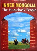
Source Book
"Inner Mongolia - The Horseback People"
( available from our Online Store )
Bulgan
Hohhot
Yinchuan
Hailar
Hovskol
Local Topography of Chifeng Prefecture :
Economy of Chifeng Prefecture :
No information available.
Chifeng Prefecture Today :
No information available.
Chifeng Landmarks & Monuments
Chifeng Pref. & Area Maps
The main landmark of - no information available.
There is no maps of Chifeng City Prefecture.
For all Maps relevant to Inner Mongolia Autonomous Region of the past and present, please refer to:
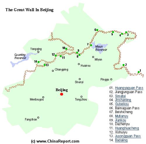
Map of Beijing City Province and ALL Locations of The Great Wall of China visitable within Beijing City Province and Immediate Vicinity.
Browse the Map to Find the Great Wall at far away Yellow Cliff (HuangYaGuan), little known JiangJun Guan, Steep and Eroded Simatai, world famous Jinshanling - the longest Great Wall Site in existence, Gubeikou, White Horse Pass (Bai Ma Guan),Beishicheng, Mutianyu, Jiankou, DaZhenyu, Huanghuacheng, XishuiYu, Juyong Guan Pass and Fortress, and finally Badaling the most visited Great Wall of China Site in the Peoples Republic.