The Chengde Maps Index gives acces to all Maps relevant to the city and prefecture of Chengde in Hebei Province and Area's of Specific Interest within that area, as used and/or produced by ChinaReport.com. Please use these Maps to find your way easily around the Province, Cities, Area's and many Monuments & Landmarks.
A Satellite image Based Map of China and East-Asia, with a super-imposed schematic Map of the Location and Path of the Great Wall as constructed during the Reign of the Ming Dynasty.
Included for reference are Locations and Names of Passes on the Great Wall of China and their significance. Further Reports link to More Photos and History & Backgrounds of each Great Wall of China Site. Further depicted are City names, geographical features of landscape, rivers and more.
Historic Maps relevant to Hebei Province
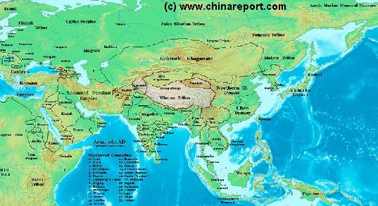
China Report - Map of Ancient Asian Empires and Tribes in Asia 565 AD
An overview Map of Asia Entire clearly demarkating the Territories, Nations and Tribal Area's of the Continent in the year 565 AD. Japan is split between the Yamato Kingdom and Emishi. In Korea three Kingdoms Rule among which the largest Goguryeo. China is split in a Northern Dynasty of the Qi, and a Southern Dynasty of the Chen.
While in the Far west the Qi Empire stretches as far West as Dunhuang, the Silk Road is temporarily blocked by the unification of
Mongol Tribes in the Gokturk Khanate and the appearance of the smal XiYe City State in the Tarim River Basin.
China Report - Map Yuan Dynasty Mongol Empire in Time (1206 AD - 1294 AD)
A Schematic Map of the Mongol Empire of Genghis Khan (TeMuJin) and descendants through its several stages of conquest in its short but Impressive Existance in History. Timeline depicts the Mongol Conquest starting in the Year 1206 AD, when Genghis Khan first united the Mongol-Turkic Tribes of Mongolia and Lake BayKal becoming Great Khan. The Timeline continous through the year 1219 AD, the year 1223 AD taking Transoxiania, 1227 AD, 1237 AD when the Northern Jin Dynasty of China was annihilated, 1259 AD conquering ancient China above the Jiangste River and 1279 AD when all of China was taken and the Yuan Dynasty established under the Kublai Khan. Last is the Year 1294 AD when the Mongol Empire reached its largest geographical size and Zenith, 22% of world land area, but through lack of central leadership and over-expansion fragmented into 4 large parts, then imploded upon itself.
China Report - Historic Map - China (Qing) Empire in 1910 AD
An obviously non-Chinese but western-made Map of the Ching Dynasty Chinese Empire in the year 1910 AD, a year in which China's sovereignty has been under threat and siege for over 70 years.
In this Map of 1910 AD, made one year before the abdication of Last Ching Emperor Xuan Tung (a.k.a.Aisin-Gioro Pu Yi) and the final end of China's Feudal History, China is depicted as in its smallest boundaries and definition. Most notably the North-East (Manchuria), and Inner Mongolia, both territories nominally under Chinese Control and under Chinese Sovereignty are depicted as separate area's.
Other interesting features of the Map and geography of the Time : after the Sino-Japanese war of 1899 AD, both Korea and the Island of Formosa (now Taiwan / ROC) have been annexed by the Japanese Empire and Port Arthur (Dalian) is now a Treaty Port and a leased Base for the Russian Pacific Fleet.
North China - Beijing City Province wider Area Maps (A & B)
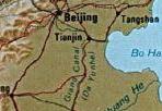
B) A very good overview Image Map of Beijing-TangShan-TianJin-ShiJiaZhuang Quadrangle in North China. Depiction of all major population centres, villages, highways, rivers, etc. in this General Area, around, East and South-East of Beijing.
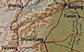
A) A very good overview Image Map of Datong-Beijing-TaiYuan-ShiJiaZhuang Quadrangle in North-China with Beijing City Province. Depiction all major population centres, villages, highways, rivers, monuments, mountains in this General Area West and South-West of Beijing.
Hebei Province Map 1 - Schematic Map - Large
A schematic overview of North-East China's Hebei Province entire, delineating Provincial Borders and parts of neighboring Shanxi-, LiaoNing- and Shandong Provinces and Inner Mongolia Autonomous Region. Includes Cities and Towns (shown by size), Main Monuments & landmarks, Main Mountains (with Height), major highways, railroads, waterways, and Airports (National & International) and links to furher information on Cities, Monuments and main transportation hubs of the wider Region.
Hebei Province Map 2 - Geographic Map
A Geographic Map overview of North-East China's Hebei Province entire, delineating Provincial Borders and parts of neighboring Shanxi-, LiaoNing- and Shandong Provinces and Inner Mongolia Autonomous Region. Map includes Great Wall of China Locations in Hebei Province, Main Cities and Towns (shown by size), Hebei Province Monuments, Main Mountains (with Height), major highways, railroads, waterways, and Airports (National & International) and links to furher information on Cities, Monuments and main transportation hubs of the wider Region.
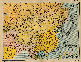
China Report - Map Ethnic Language Distribution China
Full and complete Map of China (PRC) identifying all Language Areas big and small in all Provinces and Autonomous Regions of China.
Map includes Turkic Languages (Uygur, Kazakh, Kirghiz, Salar & Uzbek), Mongolian Language and Sub-Divisions (Mongol, Tu, Daur and Dongxian), Tungusic Peoples (Oroqen, Evenki and Xibe) and Languages, Korean, Tajik (Tadzhik), Mon-Khmer (Kawa + Puman (or Pulang)), Hui, Uygur (Uighur), Tibeto-Bhurman Languages, Tai and Miao, Yao and She' Language Area's and Borders. Main Area's and sub-divisions of Han Languages (Northern Mandarin, Eastern Mandarin, South-Western Mandarin and Cantonese) further included. This color-coded ethno-linguistic Map (of 1967 AD) identifies at a glance most ethnic minority regions in China.
Satellite Image Overview of China (PRC) at Night + Cities
This Satellite Image provides an overview of all cities and provinces within the Peoples Republic of China & wider Regions.
Locations visible lie roughly between Kabul-Afghanistan in the West, Osaka-Japan in the East, Krasnoyarsk in the North and Sanya on Hainan Island in the South. Find the large coastal cities and main Chinese Civilization Centres on the Chinese Plains between Beijing i/t North o/t Plains and Hong Kong and Guanzhou (Canton) in the Extreme South. Follow the Flow of the Yellow River and cities and towns strewn along it from Xining-Qinghai Province, through Lanzhou-Gansu and Yinchuan-Ningxia to flow along the Western Shanxi Province Border and find the black holes created by the Gobi and Taklamakan Deserts as wel as Tibet-Qinghai Plateaux.
North China - Beijing-Tianjin, Hebei Province, Shanxi Province, Inner Mongolia, Ningxia, Mongolia + wider Area Maps (A & B)
See North China with Beijing and Tianjin Cities, Hebei Province, Shanxi Province, Inner Mongolia Autonomous Region, Ningxia Autonomous Region and the Republic of Mongolia at a glance and navigate the various chinese provinces and regions, capital cities of Mongolian Aimag (Provinces), rivers, lakes, landmarks and locations.
CLICK MAP AND LOCATIONS TO GO TO FULL IMAGE AND AVAILABLE INFORMATION !!
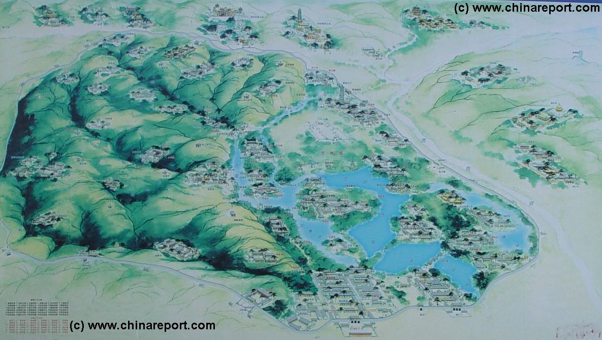
Map Chengde Fleeing the Heat Mountain Villa (Bishu Shanzhuang)
The hand drawn map provides an overview of the so-called Chengde Summer Palace a.k.a. the Fleeing the Heat Mountain Villa of Chengde in Hebei Province.
The map depicts the grounds of the Palace proper in the south, the location of each major structure and pavilion with the Chengde Imperial Gardens (the largest such prserved gardens in China today) as well as the ring of adjoining Temples, the so called eight outer temples. Landmarks and locations are marked on the map with colored dots, providing link-throughs to further information, photos and details.
CLICK MAP AND LOCATIONS TO GO TO FULL IMAGE AND AVAILABLE INFORMATION !!