Yellow River - Huang He : Menu
The China Report
History of the Yellow River (Huang He - 黃河) (6) The Ming Dynasty Yellow River
ChinaReport.com at
To Main Menu of All Websites at DrBen.Net
Go to www.drben.net webring
China Maps
China Online Sources
China Offline Sources
China Online Store
Art & Culture
History
China News
China Travel
DrBen.Net Home
China Provinces /Home
DrBen.Net Partners
China
Asia Countries /Home
Asia
China Report Club
Blog
Twitter
Forum
Chat
DrBen Live TV
China Video Library
China Photo Library
China Politics
This page was last updated on: February 2, 2017
My Great Web page
THE YELLOW RIVER DURING THE MING DYNASTY ERA:
At the beginning of the Ming Dynasty in 1368 A.D., Kaifeng the ancient Capital on the Yellow River was made the capital of Henan Province.

In the year 1391 A.D. during the early years of the Ming Dynasty (1368 A.D. - 1644 A.D.) a notebale flood occured along the yellow river. In the year 1546 A.D. another large scale flooding of the yellow river banks occured.

The year 1531 A.D. saw the completion of construction of two important sections of the Great Wall of
The Path of the Yellow River through Tibet & China :
Click Map to go to Full Version !!
Schematic Map of the Flow Path of the Yellow River through China.
Click Map to go to FULL Version !
Jinan, Capital of Shandong Province
Kaifeng (Henan Province)
Zhengzhou (Henan Province)
Luoyang, Capital of Henan Province
Taiyuan, Capital of Shanxi Province
Lanzhou (Capital of Gansu Province)
Xining / Silung (Capital of Qinghai Province)
Xi'An, Capital of Shaanxi Province
Yinchuan (Capital of Ningxia Hui Autonomous Region)
Beijing & City Province - Capital of China (PRC)
Go to Next Page !
      <<<< PREVIOUS: Yellow River (5) the Tangut Xixia and the Mongol Empire >>>>
Go to Next Page !
To History o/t Yellow River (5) Tangut Xixia and the Mongol Empire
Shanghai City & Province
Qinhuangdao City, Hebei Province
China, closing two vital strategic gaps in the already extensive defenses in the North. These were the Sanguankou Pass Great Wall south-west of Yinchuan inside a Pass of the Helan Mountains, and secondly; the Shuidonggou Great Wall of China, closing the gap between the Ordos Desert and the East Bank of the Yellow River. Notably, these were the locations of the Mongolian Invasions of the Tangut Empire (which was almost expunched from history until archeological finds in the late 19Th and 20th century) , before their assault on Song Dynasty China in the 13th Century.

In the year 1556 AD the deadliest earthquake in Chinese History struck right in the middle of the Yellow River Basin. The 1556 Shaanxi earthquake (Chinese: 华县大地震; pinyin: Huàxiàn Dàdìzhèn) also known as the Jiajing earthquake (Chinese: 嘉靖大地震; pinyin: Jiājìng Dàdìzhèn) killed approximately 830,000 people. It occurred on the morning of 23 January 1556 in Shaanxi. As
      READ MORE IN : History of the Yellow River (7) The Qing Dynasty >>>>
Go to Next Page ! History o/t Yellow River Part 3
To History o/t Yellow River (5) Tangut Xixia and the Mongol Empire
- Main: Path o/t Yellow River - Introduction to the Huanghe in General
- History of the Yellow River (1) Earliest History o/t River
                                 (2) Qin and Han Dynasty
                                 (3) Three Dynasties, 16 Kingdoms and Beyond
                                 (4) Sui and Tang Dynasty Era Yellow River
                                 (5) Tangut Xixia and the Mongol Empire
                                 (6) The Ming Dynasty and the Yellow River
                                 (7) The Qing Dynasty and the Yellow River
                                 (8) The Warlord Era, Civil Wars, Anti-Japanese War / WO II
                                 (9) Yellow River and The Peoples Republic of China
- Yellow River as Transportation Highway
- Today's Yellow River - 2010 and beyond
- Cultures of the Yellow River and Basin in China
- Products and Specialities of the Yellow River
historical records reveal more than 97 counties in the provinces of Shaanxi, Shanxi, Henan, Gansu, Hebei, Shandong, Hubei, Hunan, Jiangsu and Anhui were affected. An 840-kilometre (520 mi)-wide area was destroyed, and in some counties 60% of the population was killed. Most of the population in the area at the time lived in yaodongs, artificial caves in loess cliffs, many of which collapsed with catastrophic loss of life.

In the year 1580 A.D., Hohhot was founded along the great northern bend of the Yellow River in what currently is Inner-Mongolia Autonomous Region.
Hohhot was founded by Altan Khan around 1580 after the construction of a Castle at the same location. Altan Khan and his successors constructed temples and fortress in 1602 A.D. and 1727 A.D.

In the early 1640's AD, during the final episode of the Ming Dynasty (1368 AD - 1644 AD) Ming Dynasty Armies broke the levies on the Yellow River near Kaifeng in Henan leading to the flooding and destruction of the Old City, its Temple of the Chief Minister (Da Xiangguo Si) and other city monuments. The rebel armies of Li Zicheng, the one-day-fly Emperor who would take the Dragon
Throne only to be deposed by the Manchu's, advanced on the city of Beijing regardless. Only two years later the Ming Dynasty came to an end with the sacking of the Capital and suicide of the last Ming Emperor, Chongzhen at Jingshan Park.

In 1693 A.D. the Hui merchants who had established their own community north of the gate of the city's fortress established the first Mosque of Hohhot, under the auspices of the Tumed Mongols who held sway over the regions at the time.

Between 1735 A.D. and 1739 A.D. the Qing Dynasty (1644 A.D. - 1911 A.D.) built a strong garrison town near Hohhot with the goal of extending Qing Civil and Military control over the caravan routes that criss-crossed the southwestern Inner Mongolia Regions along the Yellow River.
Great Wall of China Path & Locations Map
Click Map to View !!
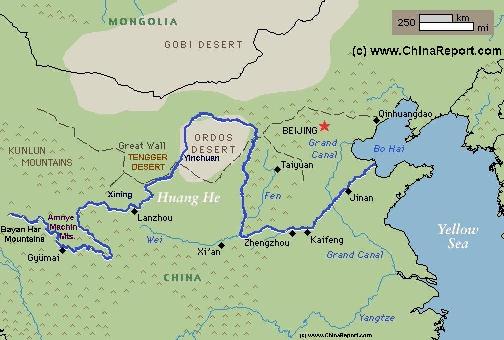
A Satellite image Based Map of China and East-Asia, with a super-imposed schematic Map of the Location and Path of the Great Wall as constructed during the Reign of the Ming Dynasty.
Included for reference are Locations and Names of Passes on the Great Wall of China and their significance. Further Reports link to More Photos and History & Backgrounds of each Great Wall of China Site. Further depicted are City names, geographical features of landscape, rivers and more.
Get our toolbar!