Among the various different ethnic groups that live in the Tibet Autonomous Region are first and foremost Tibetans. The Han (漢族) are the majority Ethnic Group.
This page was last updated on: May 30, 2017
History of Tibet Autonomous Region
Coming Soon.
Climate in Tibet Autonomous Region :
Tibet Autonomous Region climate information coming soon.
Main Rivers and Waterways of Tibet Autonomous Region :
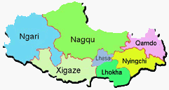
Main Cities & Population Centres of Tibet Autonomous Region :
The Capital of Tibet Autonomous Region : is the City of Lhasa.
No Information available at this Time. Coming Soon!
Introduction to Tibet (Xizhang) Autonomous Region of China
No information available at this Time. Please use available Maps.
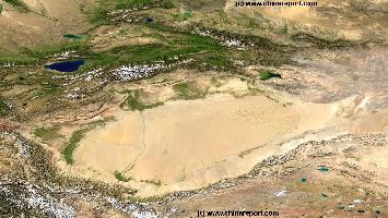
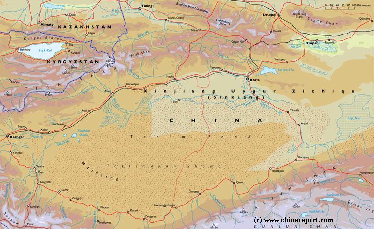
China Report - Map o/t Taklamakan Desert & Tarim River Basin
A Satellite Image Map of the entire Taklamakan Desert and the Tarim River Basin in Xinjiang-Autonomous Region of Western China.
Map gives explanation and backgrounds to Local Geography, the Flow of the Tarim River from the Pamir Mountains in the West to Lop Nur (Dry) in the East, ancient Oasis Cities of the Tarim Basin and Taklamakan Desert, the North and South Routes of the Silk Road in this Area, Past and Current Climate and Historic Backgrounds.
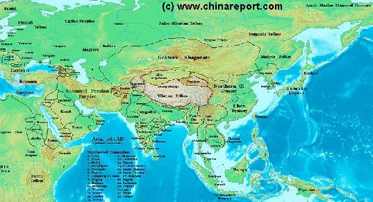
China Report - Map of Ancient Asian Empires and Tribes in Asia 565 AD
An overview Map of Asia Entire clearly dmarkating the Territories, Nations and Tribal Area's of the Continent in the year 565 AD. Japan is split between the Yamato Kingdom and Emishi. In Korea three Kingdoms Rule among which the largest Goguryeo. China is split in a Northern Dynasty of the Qi, and a Southern Dynasty of the Chen.
While in the Far west the Qi Empire stretches as far West as Dunhuang, the Silk Road is temporarily blocked by the unification of Mongol Tribes in the Gokturk Khanate and the appearance of the small XiYe City State in the Tarim River Basin.
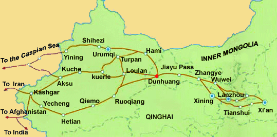
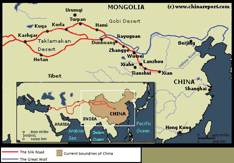
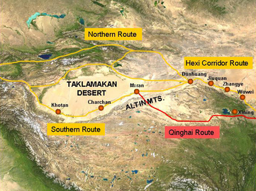
Schematic Map of the many sub-pathways of the Silk Road in China clearly showing the one-unavoidable pathway of the Hexi Corridor.
Qilian Mt Range
Mazhong
Mt Range
Taklamakan Desert
Qinghai Plateux
Gobi Desert
Gobi Desert
Tibetan Plateux
Tian Shan
Mt Range
A Full and complete Map of China (PRC) identifying all Language Areas big and small in all Provinces and Autonomous Regions of China.
Map includes Turkic Languages (Uygur, Kazakh, Kirghiz, Salar & Uzbek), Mongolian Language and Sub-Divisions (Mongol, Tu, Daur and Dongxian), Tungusic Peoples (Oroqen, Evenki and Xibe) and Languages, Korean, Tajik (Tadzhik), Mon-Khmer (Kawa + Puman (or Pulang)), Hui, Uygur (Uighur), Tibeto-Bhurman Languages, Tai and Miao, Yao and She' Language Area's and Borders. Main Area's and sub-divisions of Han Languages (Northern Mandarin, Eastern Mandarin, South-Western Mandarin and Cantonese) further included. This color-coded ethno-linguistic Map (of 1967 AD) identifies at a glance most ethnic minority regions in China
Map China Ethno-Linguistic / Language Distribution China
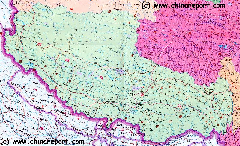
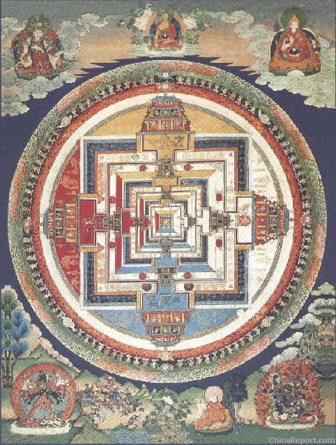
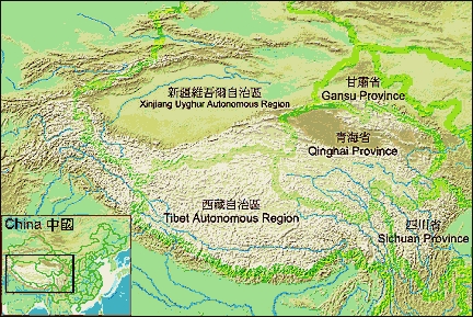
A Schematic Map of Historical Tibet, today Tibet Autonomous Region, Qinghai Province and a part of Sichuan province.
Included for reference are current International Borders, provincial borders, locations and names of main cities and towns, main rivers and lakes, mountains,importantTibetan-BuddhistMonasteries and other places of significance.
Further Reports link to More Photos and History & Backgrounds of each City, Town or Ethnic Community of Yugur, Dongxiang Tibetan, Lhoba, Kazakh, Mongol or others where available.
Today Tibet only exists as Tibet Autonomous Region of China. Tourist visits require an aditional visa !
A Magnificent film documentary on Qinghai, Tibet and Mongolia, All destinations along Marco Polos route over the roof of the World. - Click Here
The Story of the Invasion of Tibet by Chinese Forces and the subsequent Flight of the Dalai Lama. Must See !
Buy it - Click Here
An attempt to Summit Mount Everest. Filmed from Start to Finish with the Complete Struggle. Must See !
Buy it - Click Here
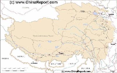
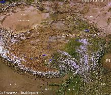
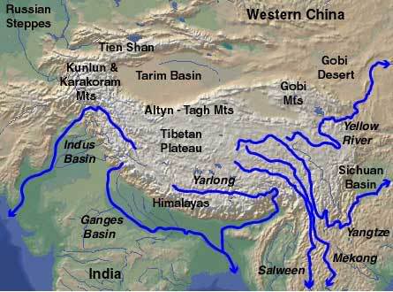
Tibet-TibetanPlateaux-SatelliteImageOverview 1A
A SatelliteImage overview Map of the entireTibetanPlateauxincluding parts of bordering regions of Xinjiang-UyghurAR, Gansu Province, NingxiaHuiAR, Inner-MongoliaAR,Sichuan Province,andYunnan Province. Surrounding nations and Territories are: Myanmar (Burma), Bhutan, Sikkim, Nepal, Bangladesh, India, Kashmir and Pakistan.
This Map clearly defines Provinces and Regions, main mountain ranges, main rivers & lakes of the region, locations of main cities and landmarks.
Transportation & Travel Connections in Tibet Autonomous Region :
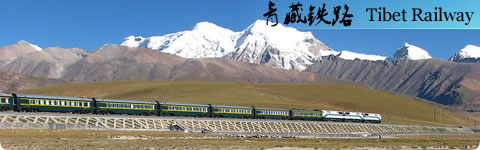
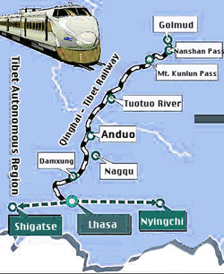
RAILROADS IN TIBETAR:
Full Information Coming Soon !
ROADS & HIGHWAYS IN NINGXIA:
Main Road connections within Ningxia correspond with local natural boundaries and ancient travel routes.
AIRPORTS IN TIBET AR:
The airports currently available in Tibet are Gonggar Airport near Lhasa, Bamda Airport in Qamdo Prefecture and Mainling airport in Nyingchi County (林芝地区).
The Gunsa Airport in Ngari is scheduled to start operations on July 1, 2010, after which it is expected to become the fourth civil airport on the "Roof of the World".
Peace Airport for Xigaze prefecture is to be completed before the end of 2010.[22]
Nagqu Dagring Airport is expected to have the world's highest altitude airport by 2011 at 4,436 meters above sea level.
Economy of Tibet Autonomous Region :
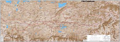
China Report - Tibet - Relief Map of Central Tibetan Plateau
A detailed Relief Map of Tibet - The Central Tibetan Plateau.