To The China Report Main Menu
This page was last updated on: May 6, 2014
The China Report
Khara-Koto - Heicheng (Chinese: 黑城) - Black City
Go to www.drben.net webring
Yanzhi Shan (3978 meters)
Badain Jaran
Desert
Hei River
Ejin River
Juyan Lake
Area
Site of Ancient Kharakoto, Capital of the Tangut Empire
Gaotai
Shandan
Sunan
Shandan Army (PLA) Horse Farm
Shandan
Dahong Shan (Height: 1924 meters)
Mati Si - Buddhist Caves - UNESCO World Cultural Heritage Site
Qin Ling Mts
Sanguankou - Helan Pass Great Wall of China
Great Wall of China at GuYuan
Qiaowan
Jinchang
Yumen
Gantang
Nangchen
Songwei (=Zhongwei) (Ningxia Hui AR)
Yanchi
Delingha
Dachaidan
Chaka
Gonghe
Chaka, Qinghai Province
Huangyuan, Qinghai Province
Aksay
Golmud
Tongren (Qinghai province)
XiaHe'
Pingliang
JiaYuGuan
Zhangye
Dunhuang
QingYang
Tianshui
Kong Tong Shan (2123 meters)
Wuwei
Yang Guan Pass - 1st Gate in the West - Han & Tang Dynasty
Bei Shan Range
JiaYuGuan Fortress & Suspended Arm Great Wall (Ming Dynasty)
Mogao Caves - Buddhist Holy Site & UNESCO Wolrd Cultural Heritage
Yu Men Gate & Toll House - Han & Tang Dynasty Great Wall
Labrang Monastery
BingLing Si - Buddhist Caves
Xumi Shan Buddhist Caves
JiuGuan
Xinjiang
AR
Xi'An , Capital of Shaanxi Province
JiaYuGuan
DunHuang
Republic of Mongolia
Ningxia
Shaanxi
Sichuan
Qinghai
Inner-Mongolia AR
Overview Map of Gansu Province and surrounding area's. Click for Full Sized Version.
TengGer  Desert
Helan Highlands
Ordos
Desert
Gobi Desert
Gobi Desert
Taklamakan Desert
Qinghai Plateaux
Koko
Nor
<- Lop
Nur
Sichuan
Har Hu
Anxi River
Yellow River
Gannan, -- County, Gannan Tibetan Autonomous Prefecture, Gansu Province, China (P.R.C.).
DingXi, Dingxi Prefecture, Gansu Province, China (P.R.C.).
BaoJi (Shaanxi Province)
PingLiang
QingYang, Qingyang Prefecture, Gansu Province, China (P.R.C.).
Wu'Du
XiaHe' + Labrang Monastery
JinChang
Anxi
LiuYuan
YaDan Land-forms
JingTie Shan (5206 meters)
Qilian Shan (5564 meters)
Maji Shan - Buddhist Holy Mountain & UNESCO World Cultural Heritage Site
TianShui, Tianshui Prefecture, Gansu Province, China (P.R.C.).
Sanwei Shan (2520 meters)
Liu Pan Shan (2928 meters)
Helan Shan (3556 meters)
Yinchuan, Capital of Ningxia Province
Alxa Youqi (Inner Mongolia)
Nanhua Shan
DingBian Great Wall of China (Ming Dynasty)
ZhongWei Great Wall of China (Ming Dynasty)
YongChang Great Wall of China (Ming Dynasty)
Bai Shan - White Mountain (Height 2013 Meters)
Xingxingxia (Xinjiang-Uygur AR)
Mazong Shan
Mazhong Shan - Horses' Manes Mountain (2584 meters)
Gongpuquan (Pass)
Jiangjuntai
Qiaowan
Anxi
JiuGuan
Dingxi
Lanzhou
Gannan
Linxia
LinXia, Linxia County, Linxia Hui Autonomous Prefecture, Gansu Province, China (P.R.C.).
Xining
Xining, Capital of Qinghai Province
Wudu
Yinchuan
Xi'An
Wuhai
WuHai, Wuhai Prefecture, Inner Mongolia Autonomous Region, China (P.R.C.).
Zhangye
Yellow River
Bayan Har Mts
Golmud, Qinghai Province
Yellow River
Yellow
River
Menyuan, Qinghai Province, China (PRC).
Jiuquan Huangnibao Yugur Autonomous Township o/t Yugur Nationality, Gansu Province, China (PRC).
Shizuishan, Ningxia Province
Amnye Machen Mts
Heimaha, Qinghai Province
Gonghe, Qinghai Province
Darin, Qinghai Province
Darin
Dachaidan, Qinghai Province
Delingha, Qinghai Province
Tuosi
Lake
Dabuxun
Lake
Gandan (Gansu Province)
Yanchi, Yanchi County, Wuzhong Prefecture, Ningxia Hui AR, China (P.R.C.).
Diedu
Die'Du
Magu
MaGu
Jiuzhi (Qinghai province)
He'Nan (Qinghai province)
Xunhua (Qinghai province)
Huashixia, Qinghai Province
Maduo, also: Madoi, Madoi County, Golog Tibetan Autonomous Prefecture, Qinghai Province, China (P.R.C.).
Madua
Qingshuihe, Qinghai Province
Xiawu, Qinghai Province
Nangchen, Qinghai Province
Longshi, Qinghai Province
Gyaring
Lake
Xiawu
Yumen
Alxa Youqi
Ejin Qi
Aksay- Capital of Aksay Kazakh Autonomous County, Gansu Province, China (PRC).
Huixian
Moon
Canyon
Huixian
WuWei, Wuwei Prefecture, Gansu Province, China (P.R.C.).
Sunan Yugur Autonomous County o/t Yugur Nationality, Gansu Province, China (PRC).
Gaotai
Ejin Qi (Inner Mongolia)

View Larger Map
Location of Khara-Koto in Inner-Mongolia, by Google Maps.
Travel directions to Khara-Koto ruins :
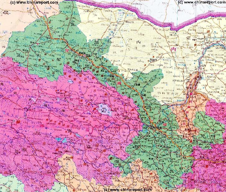
Various travel routes to Khara-Koto (Heicheng in Chinese or Halahaote in Mongolian) are under research.
The main route driving route to reach Khara-Koto site is to travel from Jiuquan in Gansu Province northward along the Hei River to reach the town of Ejin Qi. However, this route is generally off-limits to any foreign National due to the Presence of the Jiuquan Space Launch Facility, a top-secret base. Armed Police patrol the route.
From Jiuquan arrange transport to Ejin Qi, then travel to the Khara-Koto Site located at GPS Coordinates: 40° 15' 7" North and  111° 27' 30" East, which is some 30 kilometers from Ejin Qi.
The driving distance from Jiuquan in Gansu northward to Kara koto is about 440 km with an estimated driving Time of 13 hours 47 mins. Count extra time for rests and stop-overs. Most of the route leads through deserted regions without much civilization known as the Badain Jaran Desert. Traffic can be sparse. Travel prepared and with sufficient water.
The driving route from Jiuquan to Heicheng is listed below for maximum accuracy.
NOVA's grand documentary - Find out new anthropological facts on the history of China, the Silk Road and the great migrations of early mankind.
Buy the Documentary now - Click Here !
The Desert Mummies of Mongolia, Qinghai and West China - Best Product !!
To Main Menu of All Websites at DrBen.Net
ChinaReport.com at
Public Transportation - Travel Options to Ejin Qi (Dalaihubu) and nearby Khara-Koto ruins :
As mentioned, it is not possible for Foreign Nationals to travel the shortest route to Khara-Koto, which leads from Jiuquan in Gansu Province to Ejin Qi in Inner Mongolia. Foreign Nationals must therefor resort to travel via Yinchuan in Ningxia to Bayan Hot, where -after aqcuiring the essential permit- they can follow the route eastward to Ejin Qi (Dalaihubu).
Using Public Transport it is only possible to reach as far as Dalaihubu Town / Ejin Qi at 25 kilometers away. The only option then is to arrange for a Taxi (Yuan 250 return trip for a day), rent a bicycle, hitch-hike, hope for payed transport or walk, the latter of which is not advisable and possibly dangerous.

The only buses that reportedly frequent Ejin Qi (Dalihubu) originate from Wuhai, in Inner-Mongolia and Bayan Hot in Inner Mongolia. Bayan Hot ((Zuo Qi or Ba Yin in Chinese) can be reached through Yinchuan the Capital of Ningxia Autonomous Region from where many buses a day go to Ejin Qi. A Bus Trip from Yinchuan to Bayan Hot leads through the scenic Helan Pass, costs Y20 and last for about two hours.
From Bayan Hot, there are two daily buses to Ejin(a) Qi, one leaving at 8:00am and the second one at 8:20am (although this may be mistaken).

The entire route from Bayan Hot to Ejin Qi leads through The Tengger Sections of the Gobi Desert, consisting mostly of a rocky desert and few sand dunes. Except for some truck stops along the way and refueling stations there are not many signs of inhabitation. At around 12pm, the bus stops over for lunch at which Time a soldier comes onboard to check Identifications. Foreigners, including HK, Macau and Taiwanese residents need to register their names and identities, plus state their purpose of travel and stay in the Region. Normally, those on travel to Tourist sites staying for short periods are allowed through.

Modest Hotels are available in Ejin Qi. The Road between Ejin Qi and Khara-Koto has been or still is under reconstruction, however - this is only for short section, which reportedly is dirt road or open desert. Driving Time is around 1.5 Hours.

The buses back to Bayan Hot leave at 7:00 AM and 7:20 AM respectively. The Bus arives at Bayan Hot at 4pm after which immediate transfer to the Bus to Yinchuan in Ningxia is needed.
The buses to and from Ejina Qi actually strictly enforced the smoking ban.

From Ejin Qi two buses a day leave in the direction Jiuquan. They leave at 7 am and 11 am respectively. However, be warned: again - these Buses are only meant for Chinese Nationals and local people. If you're not a Chinese National you will be allowed to Travel on the Bus, however only as far as the outer perimeter of Base 20 - the Jiuquan Launch Center. There Your ID, Passport and Visa plus Travel permit will be checked and Police will drag anyone off the bus that does not have one.
1. Head west on 富康路 toward 广场西路/廣場西路 0.6 km
2. Turn right at 飛天路/飞天路 2.3 km
3. Turn right at 会丰路/會豐路 1.0 km
4. Continue on road 214 省道/酒金公路
Continue to follow road 214 省道 49.7 km
5. Turn right to stay on road 214 省道 0.2 km
6. Take the 1st left onto 鴛鴦街/鸳鸯街 0.3 km
7. Take the 1st right onto 214 省道 2.3 km
8. Turn left at 工农街/工農街 0.2 km
9. Take the 1st right onto road 214 省道/西城路
Continue to follow road 214 省道 for a total of 248 km
10. Turn left and drive for 10.6 kilometers.
11. Turn right toward road 312 省道 13.7 km
12. Continue straight onto road 312 省道 67.1 km
13. Slight right at 賽漢陶來路/赛汉陶来路 2.3 km
14. Turn left at 苏泊淖尔路/蘇泊淖爾路 2.0 km
15. Slight left at 315 省道 27.6 km
16. Turn right 4.5 km
17. Turn right 8.0 km
Check out MEGA - 100% Secure file-sharing by Kim.com !!
This page was last updated on: May 6, 2014
My Great Web page
Inner Mongolia Source
Inner Mongolia
Inner Mongolia Home
AsiaReport.com Home
China Offline Sources
China Report Home
China Online Sources
China Online Store
China Maps
China
China Photo Galleries
China Report Club
I-Mongolia Economy
I-Mongolia History
I-Mongolia Maps
I-Mongolia Transport
Hohhot
Hohhot Home
Alxa Banner
Alxa Banner Home
Bayan Nur Banner
Bayan Nur Home
Wuhai City
Wuhai Home
Ordos
Ordos Pref. Home
Ulanqab Banner
Ulanqab Home
Baotou
Baotou Home
Chifeng
Chifeng Pref. Home
Xilin Gol Banner
Xilin Gol Banner Home
Hinggan Banner
Hinggan Banner Home
Tongliao Pref.
Tongliao Pref. Home
Hulunbuir Pref.
Hulunbuir Pref. Home
I-Mongolia Minorities
Hailar
Manzhouli
I-Mongolia Rivers etc
I-Mongolia Landmarks
Yellow River
Lanzhou, Capital of Gansu Province