China Report - Map of the Gobi Desert & Yellow River Flow
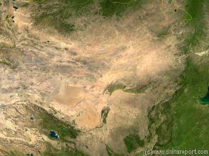
A Satellite Image Map of the Entire Gobi Desert Region and the realtive position of the City Datong in it. Map overviews North-West Xianjiang Autonomous Region, Mongolia, Inner Mongolia and North and North-Eastern China giving a Full Overview of the Gobi Deserts. Clearly visible details of geographical features such as mountain ranges, rivers, valleys and lakes, national borders, name and location details of Cities and Villages (clearly visible).
Mouse over Image to Reveal more information and follow the flow and path of the yellow river from Xining in Qinghai Province to the Bohai Sea. Details of old / former Yellow River flow (south of new) and new trajectory to the Bohai Sea.
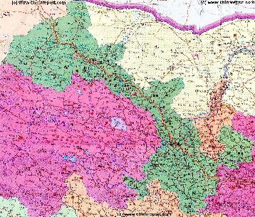
The Zhangye (Ganzhou) Report Maps Index gives acces to all Maps relevant to Zhangye and wider Area of the Hexi Corridor in Western Gansu Province, as used and/or produced by ChinaReport.com. Please use these Maps to find your way more easily around the City and Area's many Monuments and Landmarks.
Gansu Province Map 1 - Geographic Map
A Geographic overview Map of Gansu Province entire delineating provincial borders and parts of neighboring Xinjiang-Uygur Autonomous Region Province and Qinghai Province in the West, Inner Mongolia AR and Ningxia Province in the North, Shaanxi Province to the East and Sichuan Province in the South. Includes Cities and Towns (shown by size), Main Monuments & Landmarks of Gansu Province, the flow of the yellow river through Sichuan, Qinghai, Gansu and Ningxia Provinces, BingLing Si, Maji Shan and Mogao Caves UNESCO World Heritage Sites, Main Mountains (with Height), major highways, provincial railroads and main railroad-stations, and main waterways & rivers. This Map further provides links to on site photos and information on the Cities and Main Monuments Other sites will be included in the Future.
Gansu Province Map 2 - Schematic Map
A Schematic overview Map of Gansu Province entire delineating provincial borders and Main Landscape Features in Gansu and parts of neighboring Xinjiang AR and Qinghai Province in the West, Inner Mongolia AR and Ningxia Province in the North, Shaanxi Province to the East and Sichuan Province in the South. Includes Cities and Towns (shown by size), Main Monuments & Landmarks of Gansu Province, the flow of the Yellow River along the borders through Sichuan, Qinghai, Gansu and Ningxia Provinces, BingLing Si, Mogao Caves and Maji Shan UNESCO World Heritage Sites, Deserts, Mountains (with Height), major highways, provincial railroads and main railroad-stations, and waterways & rivers. This Map further provides links to on site photos and information on the Cities and Monuments.
A Satellite image Based Map of China and East-Asia, with a super-imposed schematic Map of the Location and Path of the Great Wall as constructed during the Reign of the Ming Dynasty.
Included for reference are Locations and Names of Passes on the Great Wall of China and their significance. Further Reports link to More Photos and History & Backgrounds of each Great Wall of China Site. Further depicted are City names, geographical features of landscape, rivers and more.
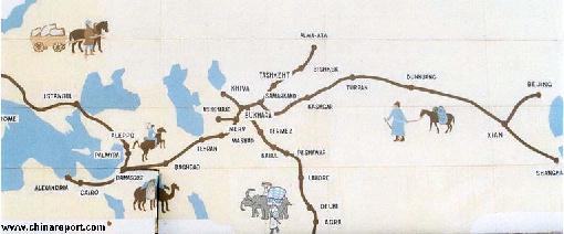
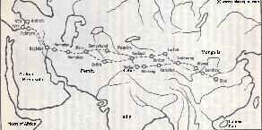
China Report - Map of the Ancient Silk Road during the Han Dynasty & Roman Age 2
A Schematic Map depicting the Full Length and main pathways of the Ancient Silk Road during the Han Dynasty Period (206 BC - 221 AD) and Roman Age (30 BC - 630 AD).
In 30 BC the Roman Empire started trading with India, which was already well known from the
Conquest of Alexander the Great (+/- 330 BC). In the following 6 centuries the West would Trade with India and indirectly also with China through the Silk Road. The Silk Road only lost its Value after the European Age of Discovery and the Establishment of Maritime Trade Routes with India (16Th Century) and later China. The Yellow River is crossed at Lanzhou, after which Dunhuang is the Last Station in China.
China Report - Map of the Ancient Silk Road during the Han Dynasty & Roman Age 1
A Schematic Map depicting other details along the Full Length and main pathways of the Ancient Silk Road during the early Han Dynasty Period (206 BC - 221 AD).
As seen from China the Silk Road extends due Westward from Chang'An (Xian) the Han & Tang Dynasty Capital. The Yellow River is crossed at Lanzhou, after which Dunhuang is the Last Station. This
Map depicts the Lost Civilizations of Loulan and Hotan, as well as the south route and north route of the Silk Road coming together at Dunhuang in current day Gansu Province of China.
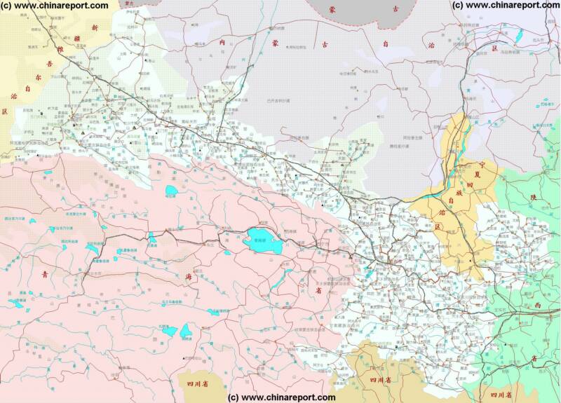
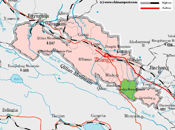
Map of Gansu Province Prefectures including Ganzhou Prefecture
Find the location of small Zhangye (Ganzhou) Prefecture and all other Prefectures of Gansu Province of China (PRC).
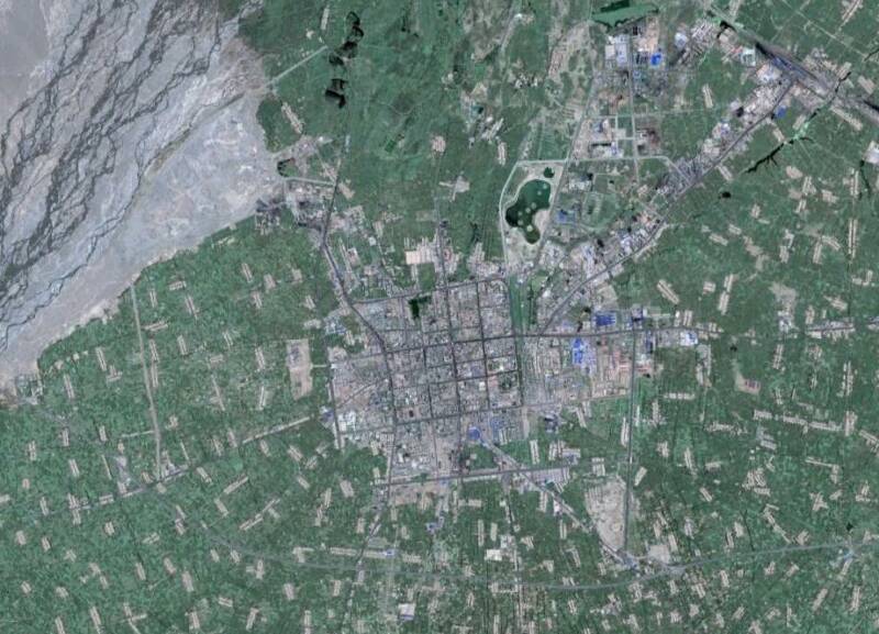
A Full Google Earth Supported Map of Zhangye by Google.com.
The China Report introduced on Levels of its Online Publishing's in April of 2009, including Gansu Province.
Find Google Maps on nearly all Report & Photo Pages where appropriate and useful.
Adjacent Map gives direct access to the City of Zhangye Map by Google.
Geographic & Historic Maps on Zhangye, Silk Road. National Highway 312 (Shanlin expressway or Lanzhou-Urumqi Highway) and related Regions of Gansu Province.
Zhangye & Area Maps
Please browse around the Town of Zhangye and wider Area using our Geographic & Historic Maps. Find out more about the City and Area through our many Photographic Reports on the main historic landmarks and Monuments and their rich history.
A Geographic Overview Map of Zhangye City Prefecture within the Hexi Corridor of Western Gansu Province.
Badain Jaran
Desert
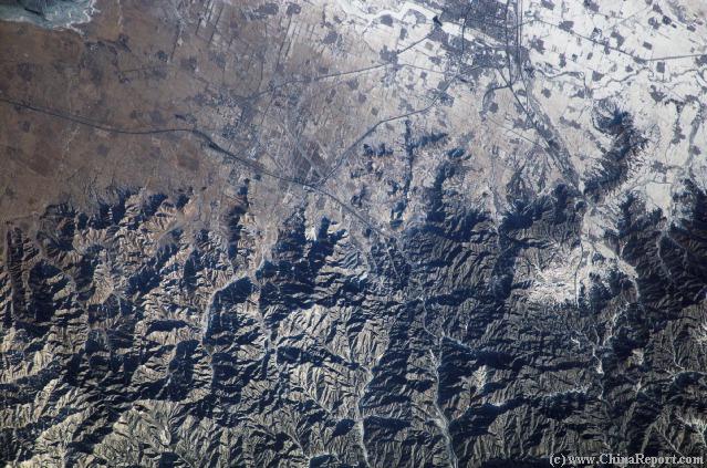
Click the Satellite Image to Go to a Full Version Image & Map.
A Satellite Image of Overview of Zhangye Town with in the Upper-Left corner the flow of the Hei He (Black River) Coming from the South to South-West. Due to damming upstream the outflow is significantly reduced as is clearly visible.
Click the Satellite Image to Go to a Full Version of Image & Map.
Base 20 - Jiuquan JSLC
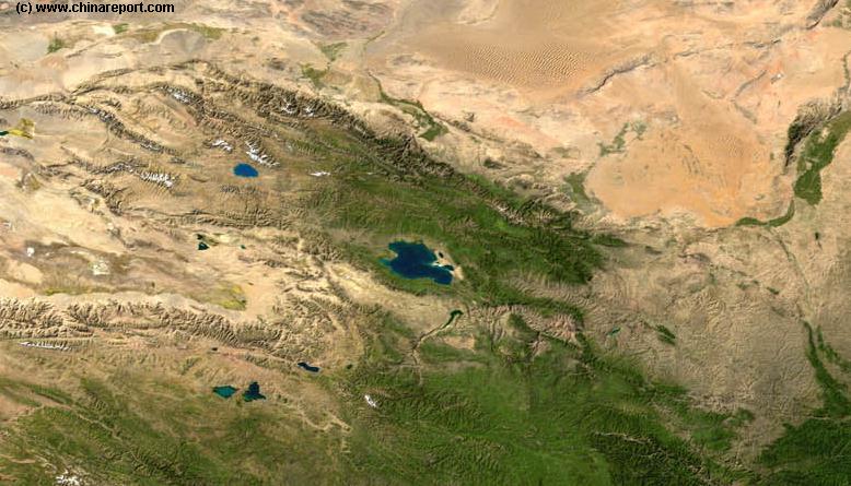
Gansu Province Map 3 - Satellite Map
A Satellite Image based Map of Gansu Province entire and neighboring provinces clearly depicting the natural terrain features that shaped the Province of Gansu in History. Browse around the Image to the outlines of the Gobi & Tengger Deserts, view the Qinghai Plateaux extending from the West providing borders with Gansu Province and Sichuan Province. Central Gansu Province around the Capital of Lanzhou is formed by the Loess Plateaux and the flow valley of the Yellow River (Huang He). Otherwise distinct areas are the Throat of China, Hexi Corridor extending to the North-West and the Ningxia Yellow River Valley, a separate autonomous region and green patch in the North-East.